Williams Canyon
Distance:
3.5 Miles
Type:
Double track then Single Track
Vertical Gain:
700 ft
Difficulty:
Easy
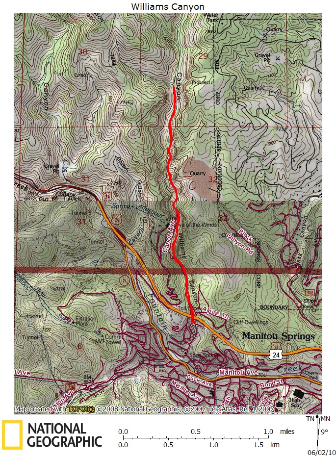
Topographical Map:
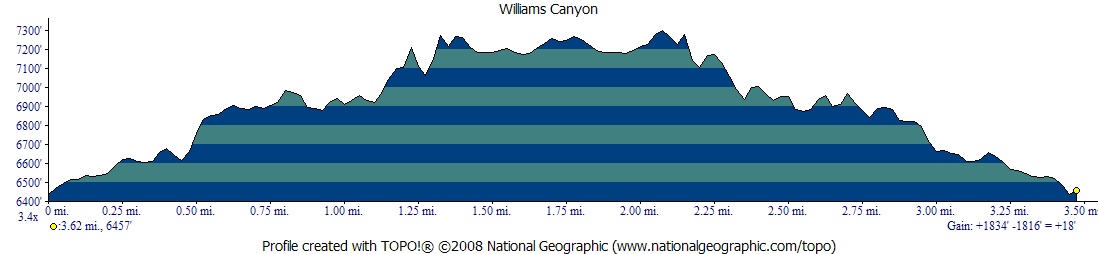
Elevation Profile:
Trailhead:
Take Manitou Ave to the Bell tower at the center of Manitou Springs at the intersection of Canon Ave and Manitou Avenue take Canon Ave north. Just beyond the Cliff House the road will come to an intersection where you must veer right to stay on Canon Ave. Continue on Canon until it crosses beneath a high overpass of highway 24. There are a few parking spots just beyond this overpass on the right side. Park here. If those are take return back down Canon Ave until you find an available parking spot. Be sure to obey all No Parking signs as illegally parked cars frequently get towed.
IMPORTANT!!: This hike is on private land and a waiver form must be filled out before hiking this trail. Go to the main office of Cave of the winds and sign a waiver before hiking. This is free and is good for one year. Doing this makes it possible for Cave of the Winds to allow hikers to enjoy this trail. Please respect their wishes. Also when you are at the office to fill out the form, please remember they are not making money on you hiking on their land so be respectful and allow them to take care of their Cave Tour customers first.
Summary:
Begin by continuing to hike north on Canon Avenue until a switch back in the road where you will see a gate with a "Cave of the Winds Exit Only" arched sign. There is also a no trespassing sign (which does not apply if you have signed the waiver at the main building). Cross this gate and continue to hike along the old exit road of Cave of the Winds. In winter this trail can be extremely icy, and in high run off the stream can take over parts of the trail. However, most of the year this is a fairly easy trail. Keep in mind you are hiking on private property with permission. If you watch the cliff walls carefully as you hike you'll see several boarded up entrances to caves. These are locked and access is granted only through a spelunking club. The road will eventually reach a switch back where it will head up towards the Cave of the Winds buildings. You can either follow the road a short ways up that switch back or you can look for the hikers trail that continues along the valley floor. The trail that continues enters public lands at that point and becomes just a single track trail. The canyon walls continue to be spectacular for a ways up the trail. This trail continues several miles, however the most scenic parts only continue for another 3/4 of a mile which is what I have mapped out. Go as far as you like though and simply return down the path you came.
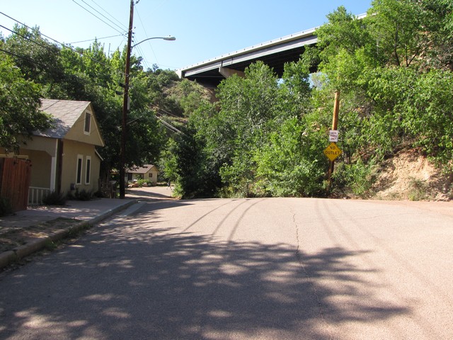
Canon Ave just before crossing beneath the Highway 24 overpass.
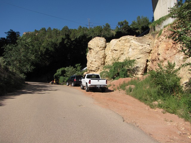
The parking just beyond the overpass.
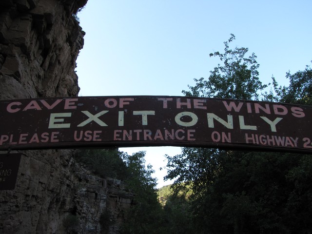
The sign above the gate, this is where the trail begins.
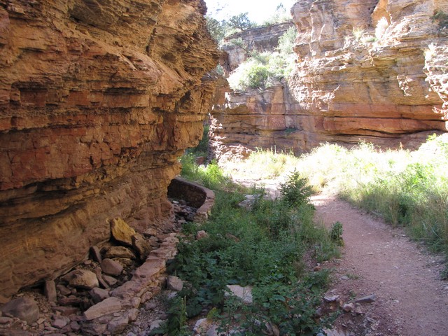
Following the old road as it winds along the canyon floor.
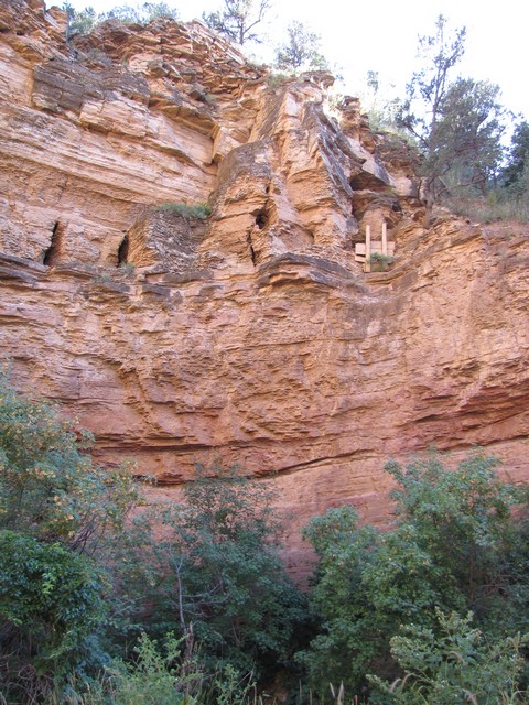
One of the many locked cave entrances.
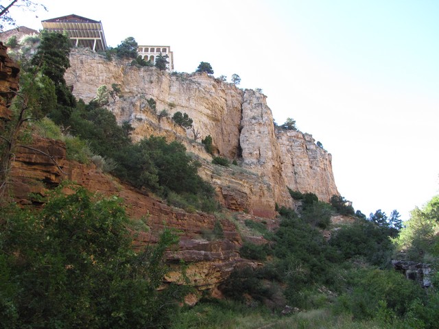
Looking up at the Cave of the Winds facility from the valley below.
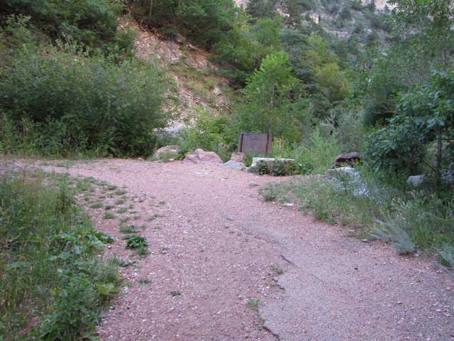
The switchback where you go left to follow the road or straight past the sign to take the hikers trail farther up the canyon.
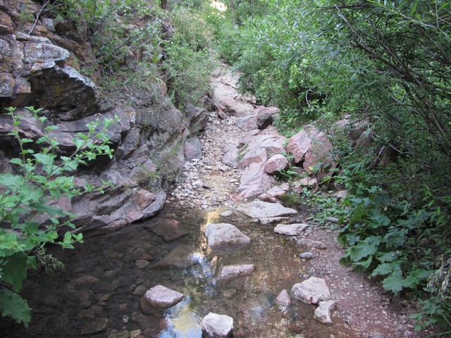
The trail is wet in several places even during low water. The canyon is lush for this part of Colorado which adds to the cooling effect of the canyon. This is a great hike for a hot summer day.
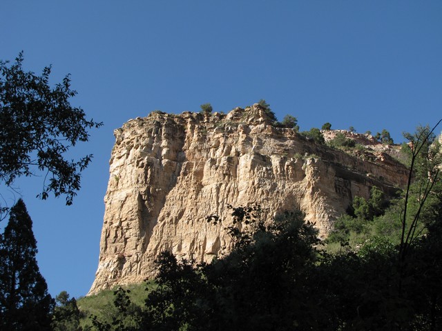
Some of the canyon wall features become quite impressive after getting beyond the Cave of the Winds land.
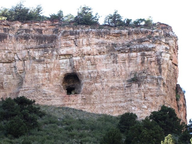
Beyond the private land there are cave entrances that are not blocked. However that doesn't necessarily make it a good idea to try exploring the caves. Spelunking without proper training is risky.
|
Distance: |
3.5 Miles
|
|
Type: |
Double track then Single Track
|
|
Vertical Gain: |
700 ft
|
|
Difficulty: |
Easy
|