
November 1, 2014
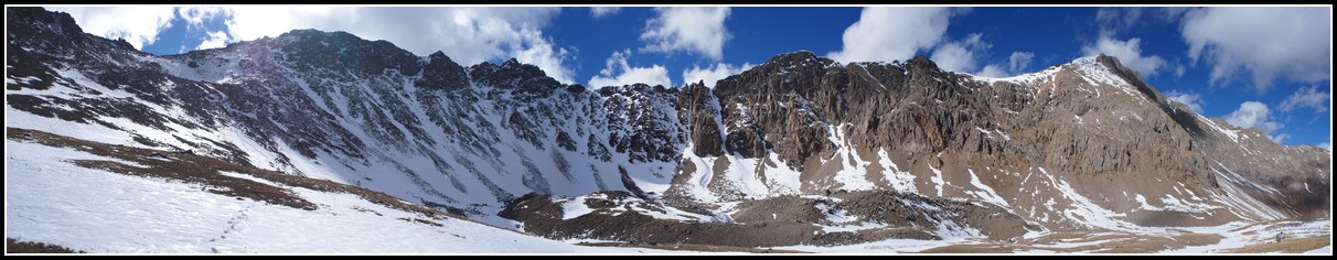
Grizzly Peak is the tallest 13er in Colorado. It is sometimes referred to as Grizzly Peak A to help identify it from the other 4 Grizzly Peaks in Colorado. At one time it was thought to be a 14er, but more accurate surveys found it to fall just 12 feet short. Some of that elevation was added back in the past decade, however it still falls 5 feet short of a fourteener. So anyone over 5 feet tall that hikes this peak will still break the 14,000 foot mark.Garfield Peak is the neighbor of Grizzly Peak and the two are easily climbed together.
Map:
Profile:
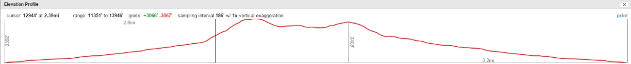
| Distance: | 7.1 miles |
| Elevation Gain: | 3,066 vertical feet |
| Time: | 7 hours |
We began hiking after 8 am. This is very late for us, but fall hikes are much different than summer or spring. The risk of afternoon thunderstorms is nearly gone, and it makes more sense to let the sun warm things up a bit before starting the hike.
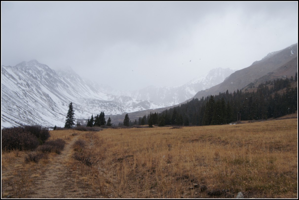
The day began with some light snow.
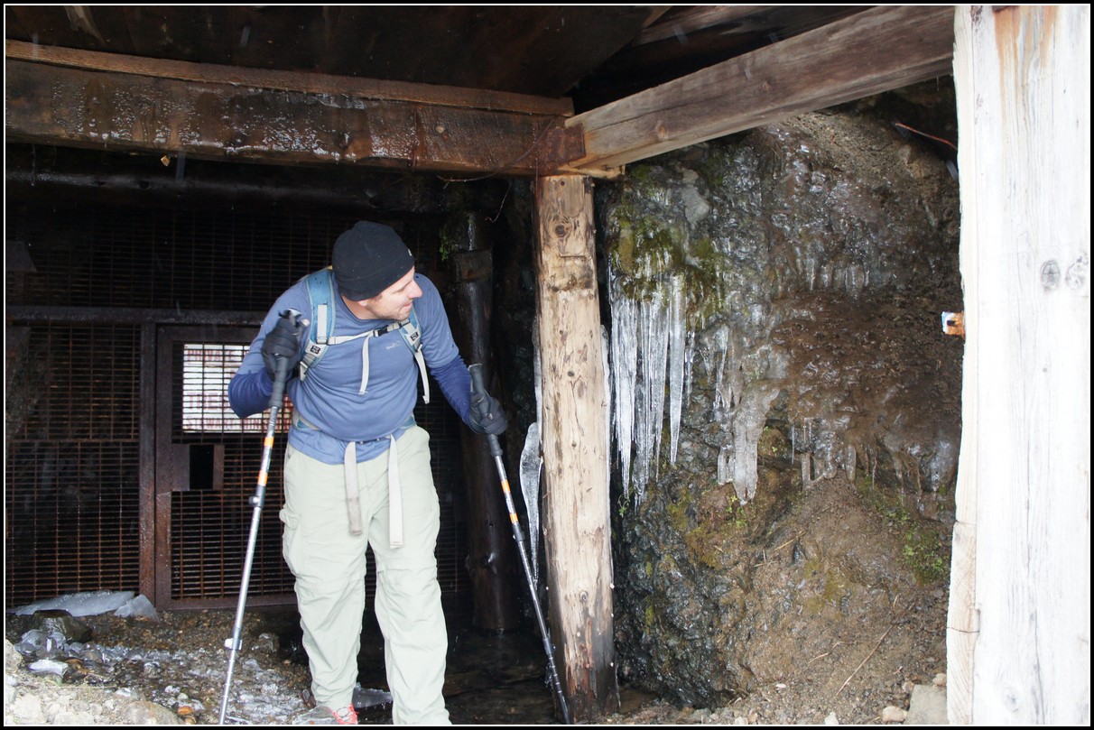
We also took a little time to explore the mines a little. The icicles in the entry to this one were quite impressive for this time of year.
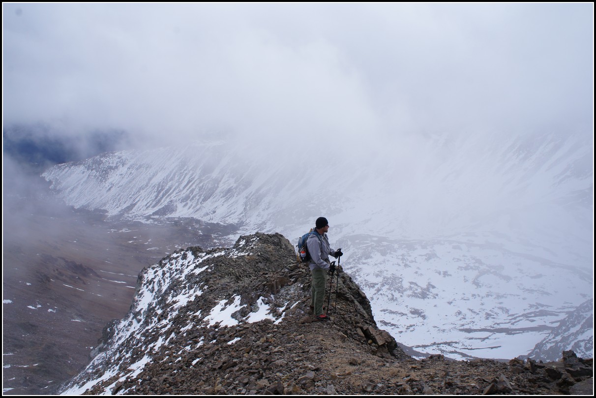
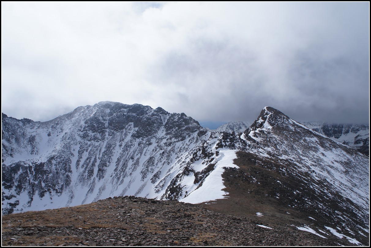
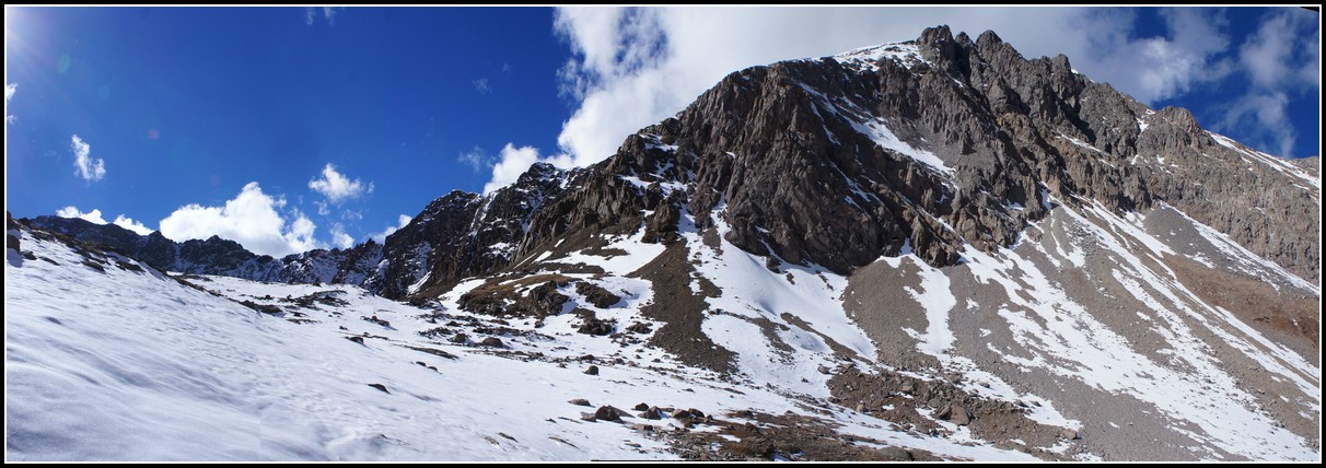
We hadn't really set out to climb Mount Garfield, but as we began heading up the slopes of Grizzly we decided that if the route looked OK and the weather held we would give it a shot. The ridge was supposed to be class two between (left side of the photo), but from the early vantage point it looked a little more interesting than that.
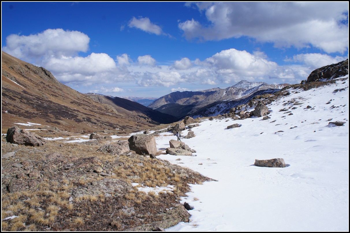
We ascended the valley a little further than we had read we should, but we wanted to delay reaching the ridge until as late as possible as the winds up high looked a little strong. (If it weren't for the winds, late fall would really be the best time of year to climb.)
This meant we had to navigate through some small cliff bands. They were crumbly at times, but a fun challenge.
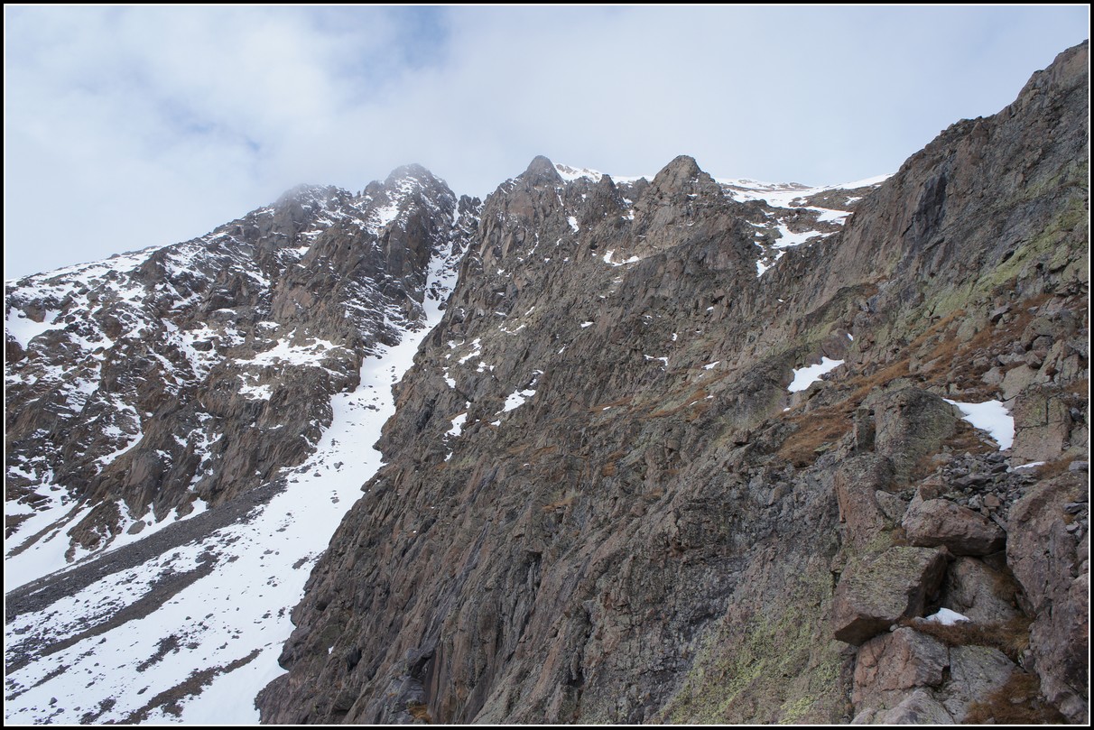
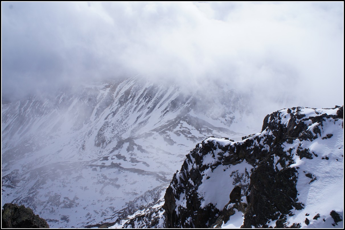
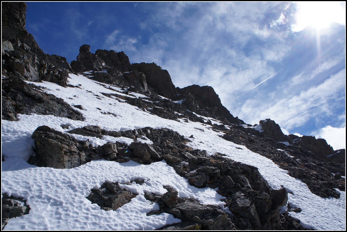
As we worked our way through the cliff bands we got a great view of a couloir that leads to Grizzly's summit. We couldn't tell for sure if the finish was doable, but it certainly looks like a fun climb. Unfortunately we were not prepared for such a climb.
The clouds continued to build, though it hadn't snowed on us for a while.
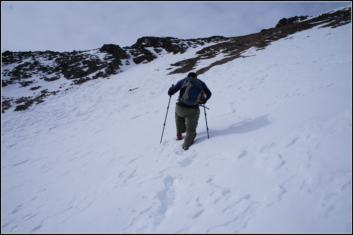
The snow we did have to cross was crusty with a weak layer underneath. Not a good sign for future stability this winter.
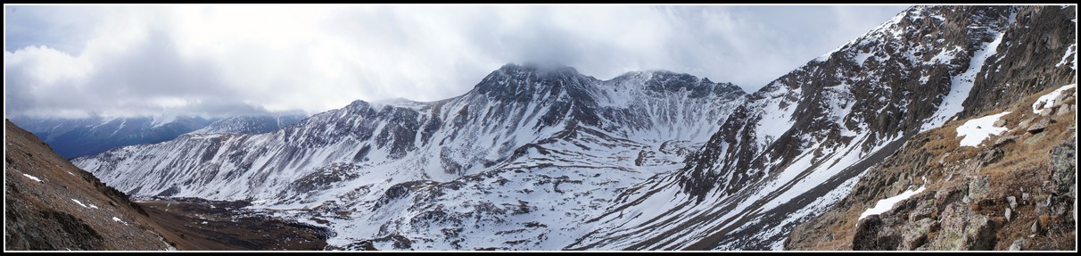
The clouds rolled through in waves, we went back and forth between miles of visibility and 100 feet of visibility.
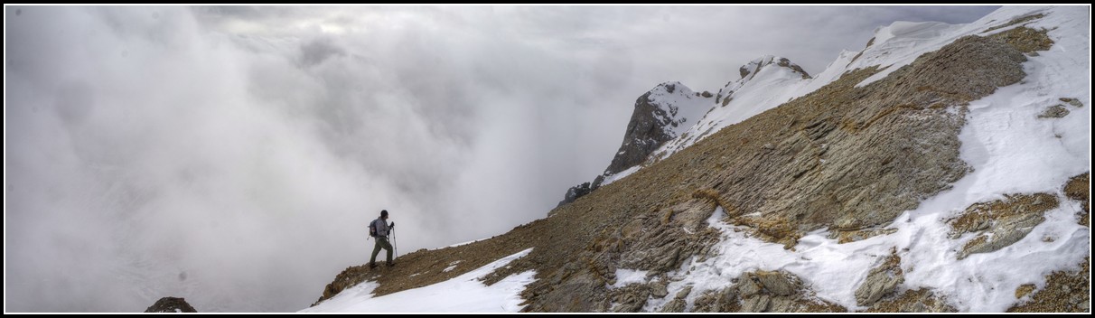
In summer weather like this is a trip ender, on a cold day in November it just adds to the experience.
When we crested the ridge we hit the wind, but it wasn't as bad as we'd expected.
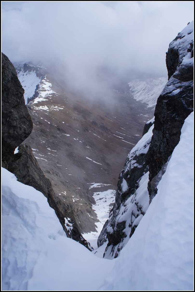
Looking down the couloir we'd checked out earlier, I think it'd be a good climb in spring but with thin fall snow it's just too sketchy at the top.
Check out the snow field on the rocks near the bottom and just right of center in this photo. Those are mountain goat tracks! Goats are crazy.
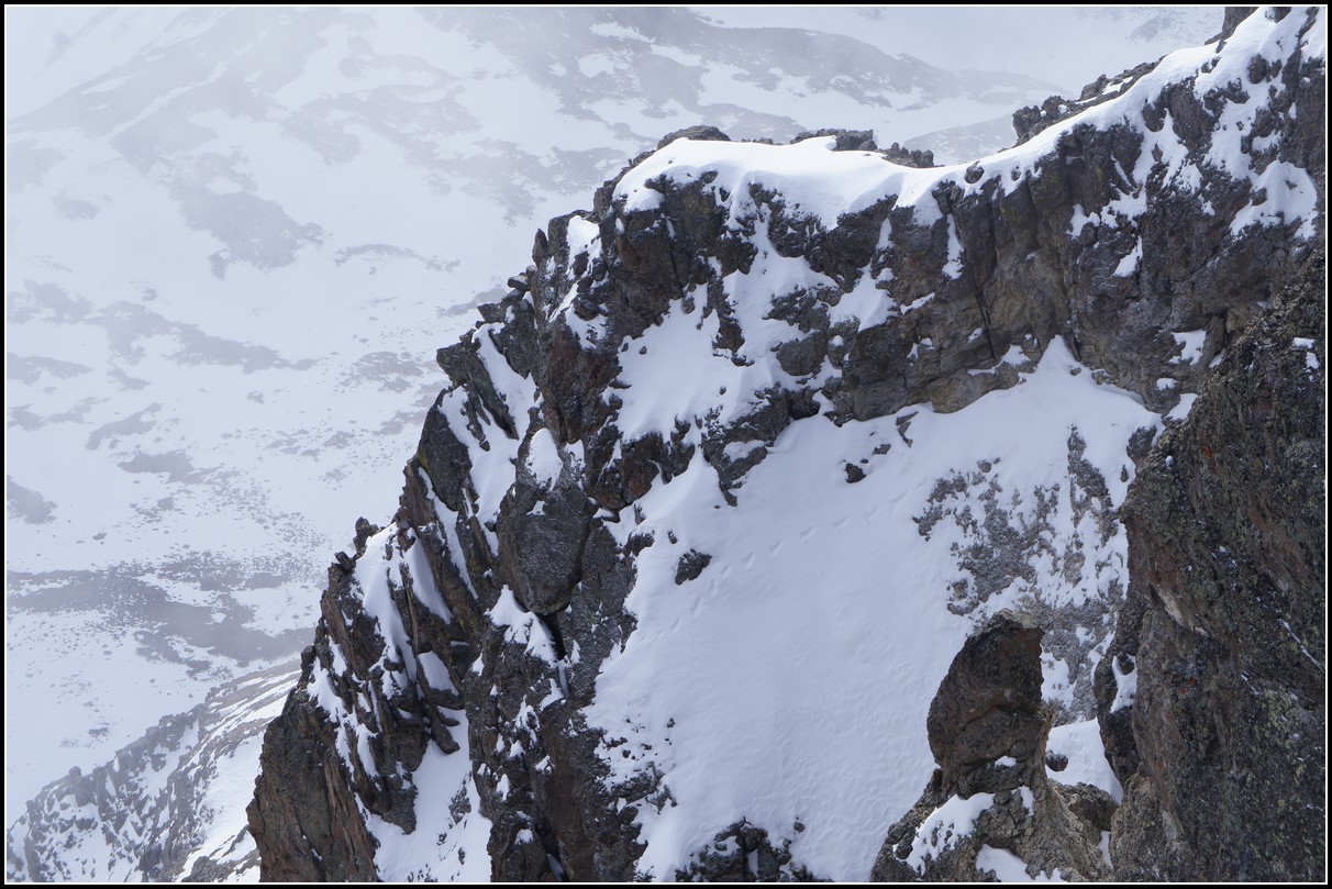
A better shot of the tracks.
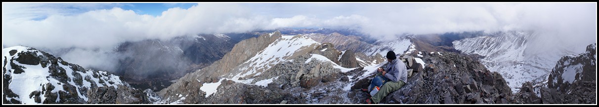
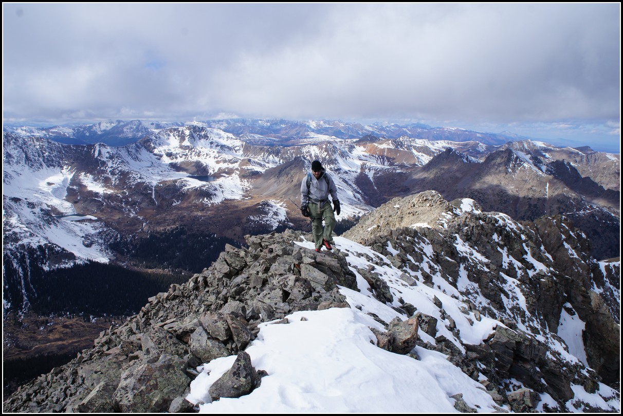
Sitting on Grizzly's summit.
From the summit we couldn't see if the ridge route to Garfield looked doable, a twin summit of Grizzly blocked our view. So we climbed over to that one, then an small ridge blocked the view, so we climbed that. Then a rock out cropping was in the way so we climbed over that.
By the time we'd done all that we were past the difficult part of the descent to the saddle and figured we might as well go for it.
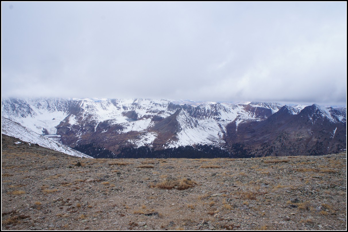
We were now hiking just below cloud level, able to see only that which was at or below our elevation.
The trip up Garfield had some fun scrambling through rock that seemed to be more from the Elk Range than the Sawatch Range.
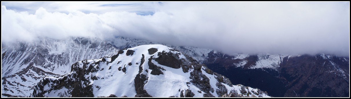
By the time we got to the summit of Garfield the clouds had lifted and we could see the gorgeous mountains surrounding this rarely visited summit.
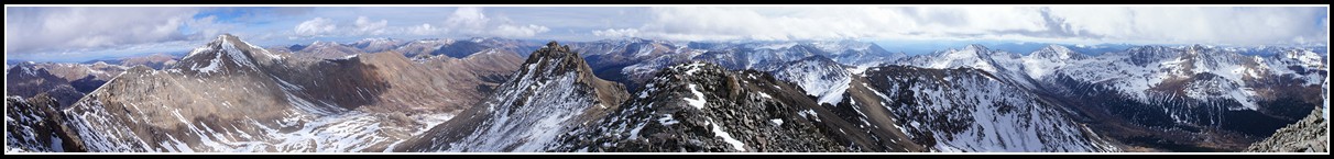
The 360 degree view from the summit.
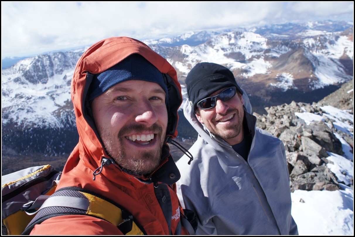
Our summit shot.
Our shadows were growing long, so we headed down. Then we realized it was only 2 pm so there was no rush. The sun stays so low in November it's deceiving.
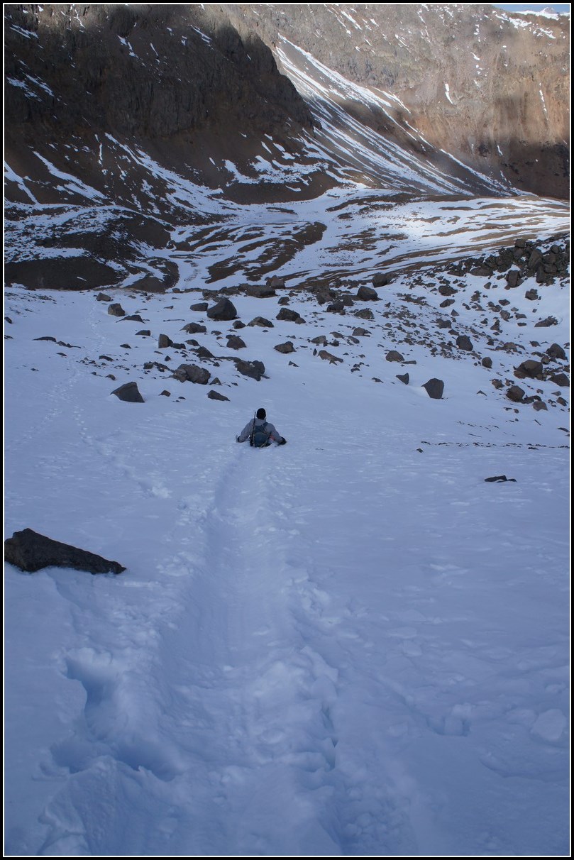
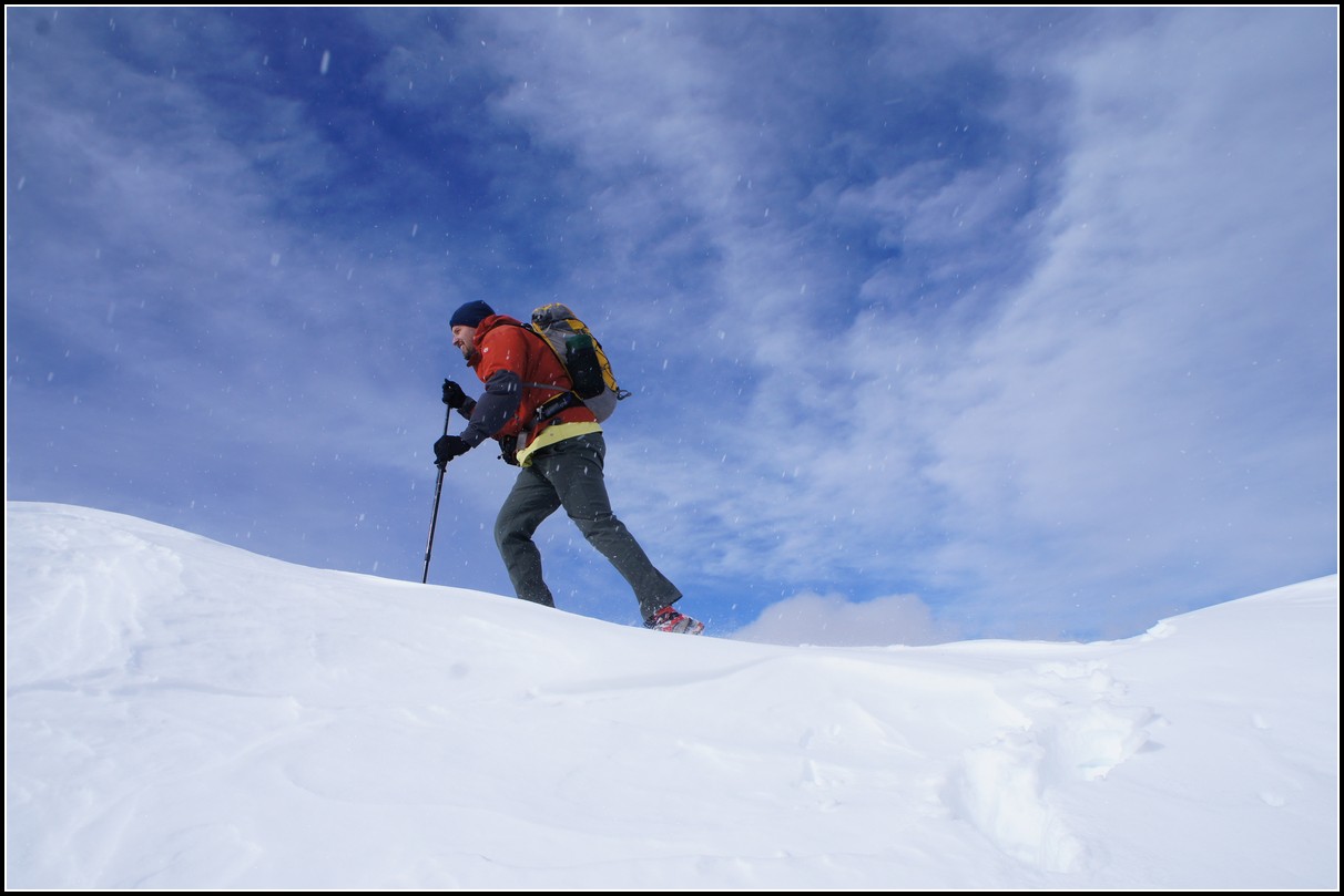
Jason managed a couple of early season glissades.
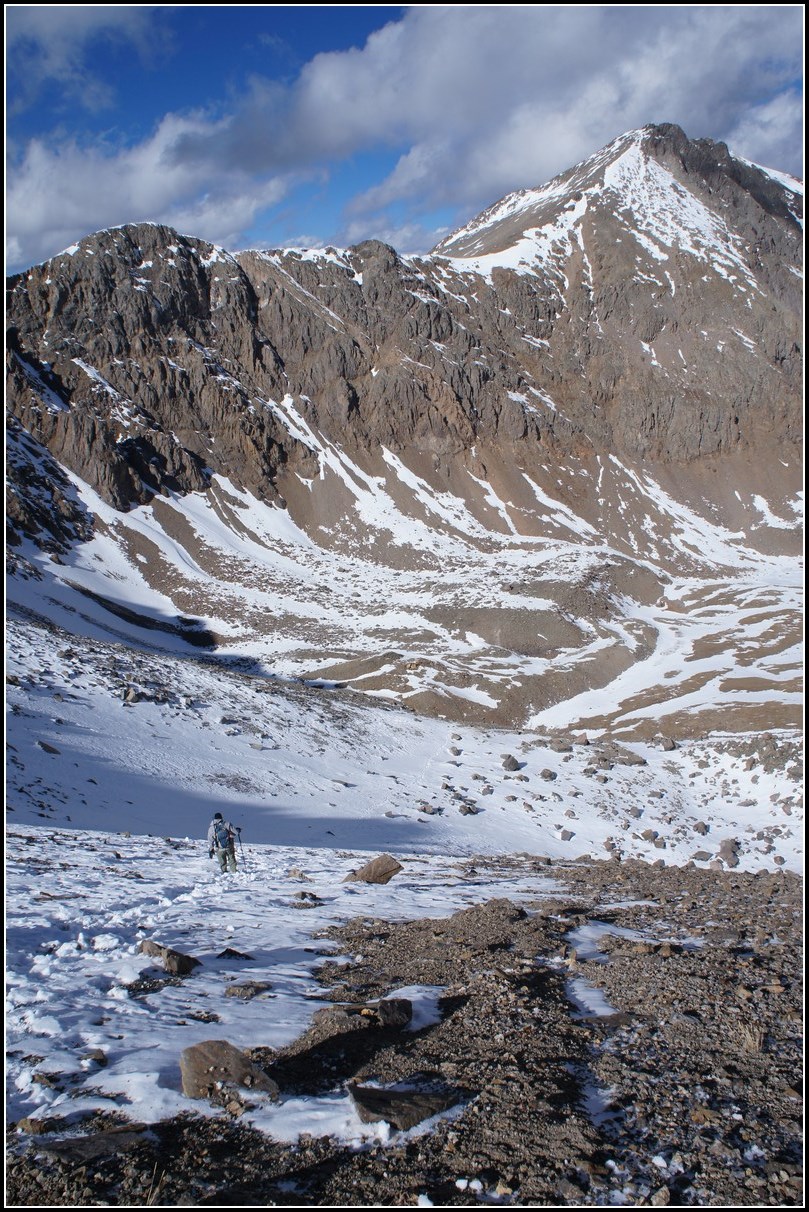
A look back at the day's journey.
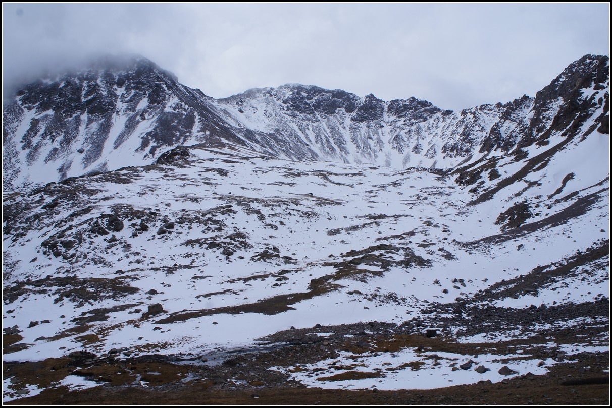
Grizzly Peak certainly is one of the most rugged mountains in the Sawatch.
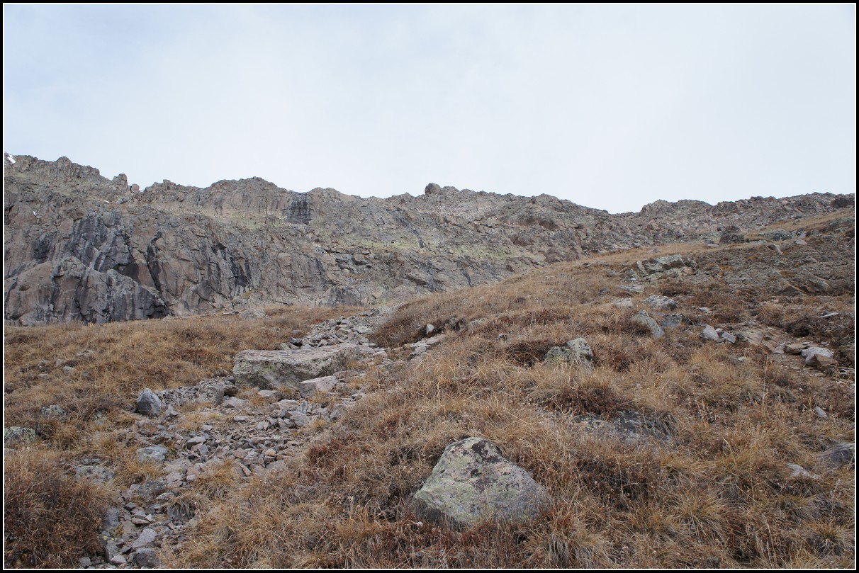
Fall conditions: bare on south facing slopes and snowy on north facing slopes.
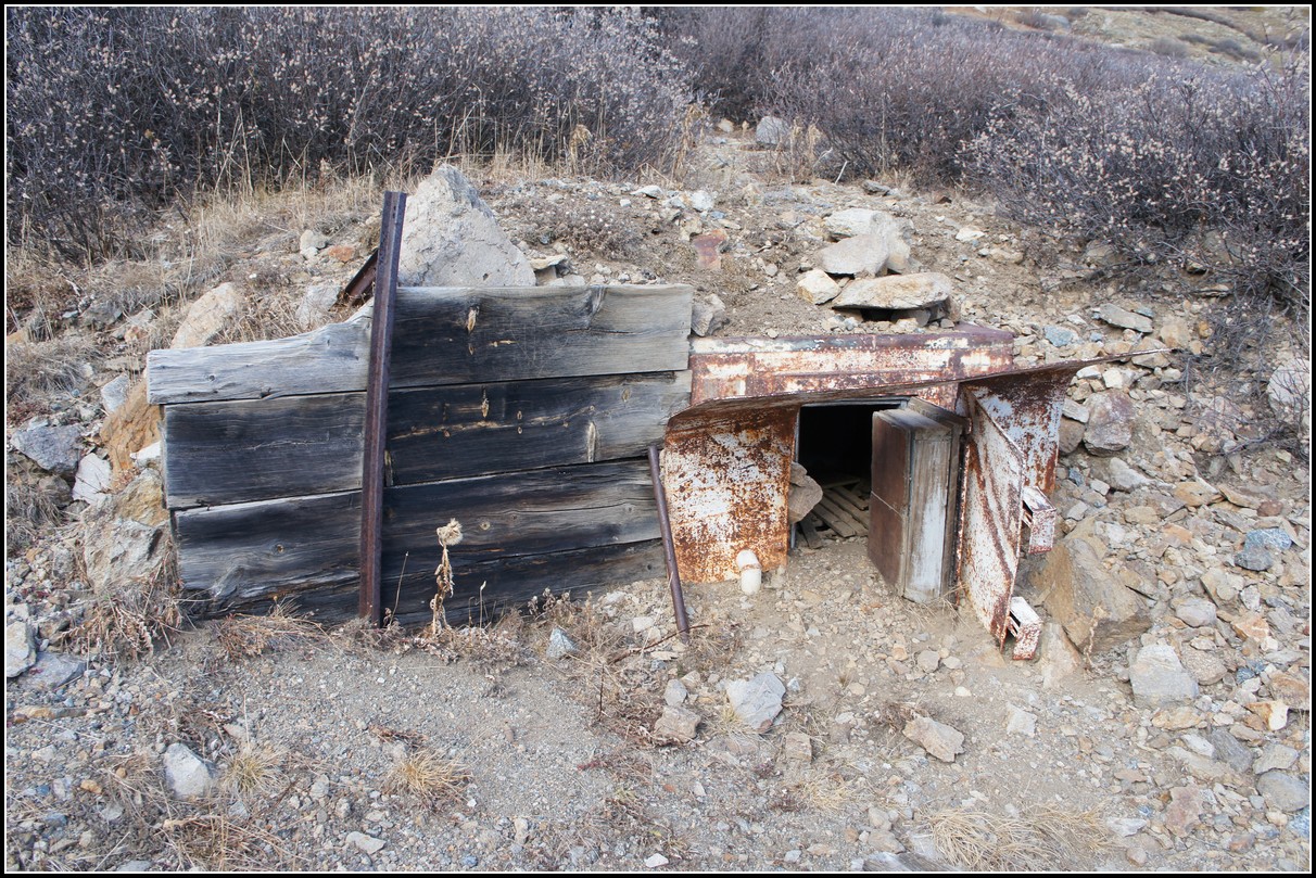
I've seen several photos of this calling it a mine. This is not a mine, it is the equivalent of a refrigerator. Notice the insulated door. It's built into the ground to take advantage of the cold ground at this elevation. It is near the mines so it might have been used to store the dynamite rather than food.
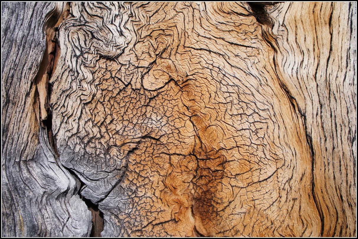
A close look at the gnarled grain in a dead tree near treeline.
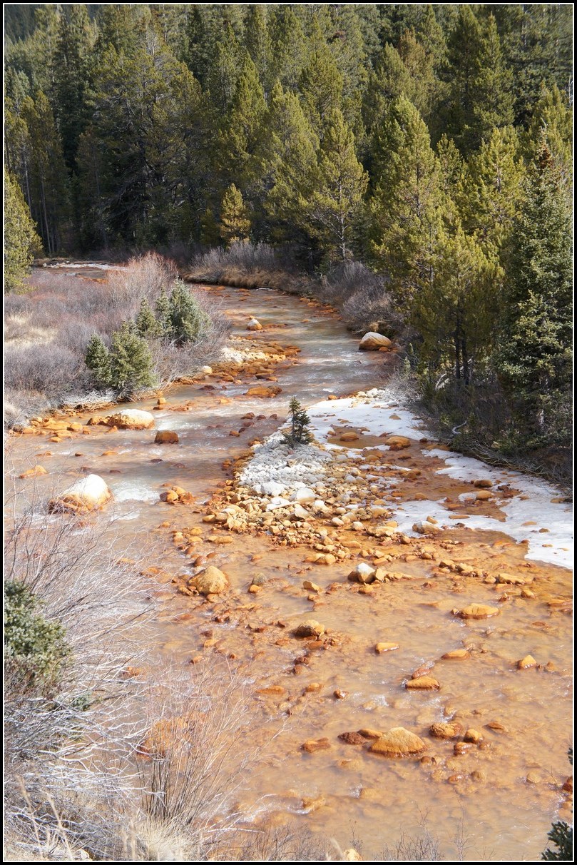
The creek flowing near the road to the trailhead is bright orange from the iron deposits it leaves, but when flowing high it leaves aluminum deposits turning the rocks near the high water mark white. Notice the white patch of rock with the two small trees growing in it, and some of the rocks on the banks. The stuff on the far right is just ice and snow. I'm guessing this is because during high water the water is only acidic enough to dissolve the aluminum and then deposit it. During lower water the water becomes acidic enough to dissolve iron and deposit it downstream. If anyone knows if my theory is correct please let me know.
You are welcome to contact me with any questions regarding questions about, or problems with, this website. Just send me an e-mail at josh_friesema@hotmail.com.