
Approaches | ||
| Bottomless Pit trail | Rumdoodle Ridge | Hero Traverse |
Routes | ||
| Y-Couloir Routes | Blind Assumption and Total Abandon | Railroad Couloir |
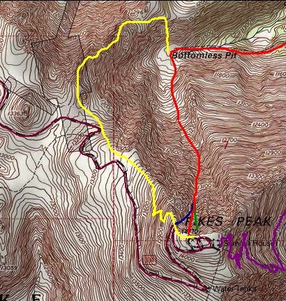
The Bottomless Pit Trail
The Bottomless Pit Trail is accessed from the Barr trail. Hike to Barr Camp from either the trailhead in Manitou Springs or ride the Cog Railway halfway to the Mountainview Trailhead. Once at the Barr camp continue west on the Barr trail for another 1.5 miles to the Bottomless Pit Trail turnoff. The turnoff is marked with a yellow sign.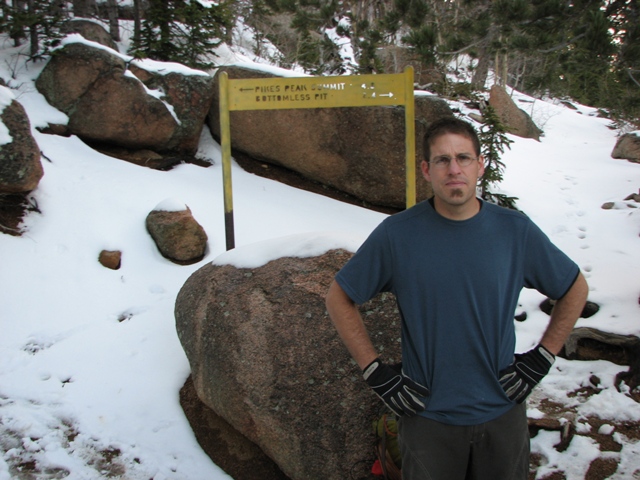
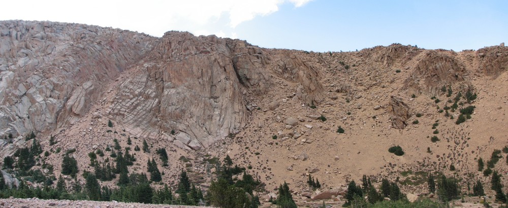
As noted on the sign follow this trail for 2.4 miles to reach the bottomless pit. You've reached the bottomless pit when you enter a large circ at treeline. Below is a panorama taken from inside the circ.
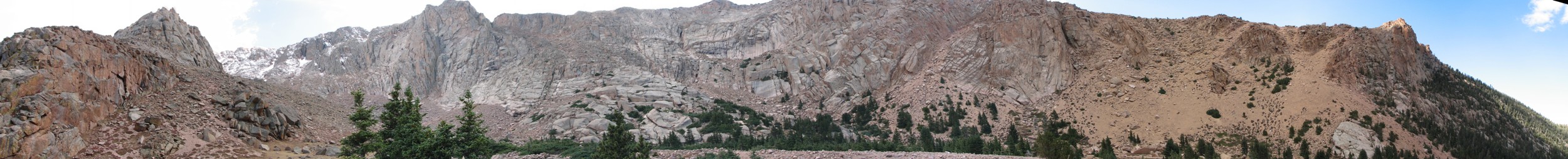
Click photo for larger version.
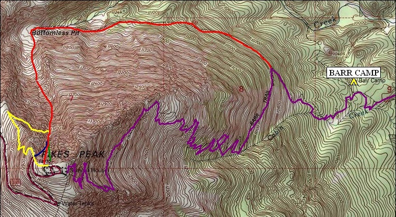
In the map below the purple line is the Barr Trail and the Red line is the Bottomless Pit Trail leading into the Y-Couloir direct.
Hero Traverse
This is the prefered access route for Total Abandon and Blind Assumption, it is also the shortest route to do the Y-Couloir. Most people begin by parking their car in the summit parking lot, then hiking east down the Crags trail. After the steep rocky descent turn North to come around to the north face of the peak and look for the steeply sloped shelf to hike across. The route is in yellow below.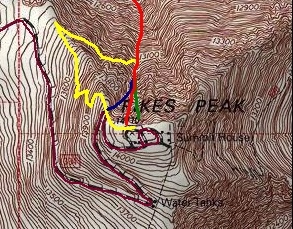
Nathan Hoobler posted a great report from the Hero Traverse to the Y-Couloir. Read it HERE.
Rumdoodle Ridge
Similar to the Hero Traverse most people begin this route by parking at the summit of Pikes Peak and then hiking down. Rumdoodle will take you to the very bottom of the Bottomless Pit and therefore give you access to everything on the north face. From the parking lot on the summit begin by hiking west on the Crags trail. You will be able to spot the ridge from early on. There is no well defined trail on this ridge so look at the ridge and plan your route as you approach it. Once you reach the ridge follow the ridge proper north.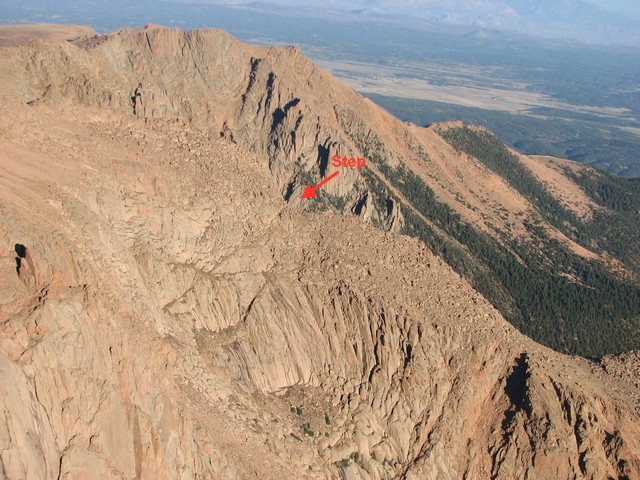
Soon after getting on the ridge you will reach a step. Though steep, careful route finding will keep it from being too difficult. Continue down the ridge until you reach the couloirs that descend into the Bottomless Pit.
The above photo shows the couloirs that can be used for a descent. Choose the couloir that works best for you.
The route is in yellow on the map below.
Click here for a great trip report using the Rumdoodle Ridge.
The Y-Couloir
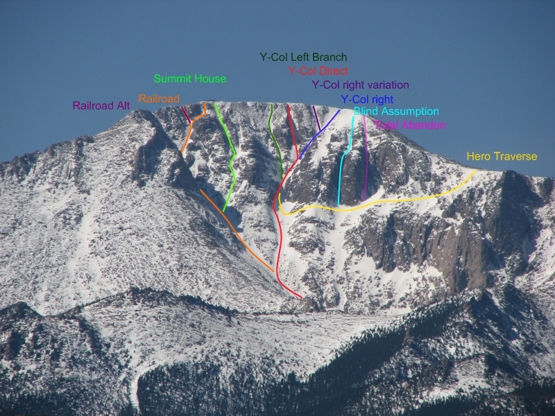
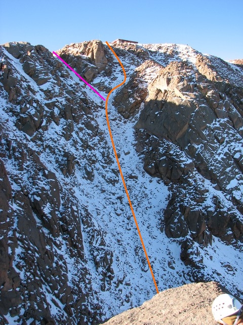
The Y-Couloir is the most popular of the north face route, but is also the most misunderstood. The Y-Couloir is inappropriately named. The name implies that there are two branches, there are however three main branches (one of which has an alternative finish). Gerry Roach in his book Colorado's Fourteeners also describes the Y-Couloir as having only two branches. Oddly enough the one that he leaves out (which I refer to as the Y-Couloir Direct) is the most commonly used route. Below is an ariel view of the different finishes to the Y-Couloir.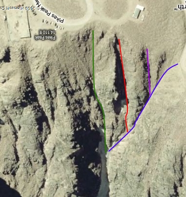
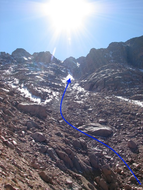
To reach the base of the Y couloir head southeast from the bottomless pit following the main gully. Watch to your right for the Couloir. It heads straight into the first large opening in the cliffs.
Branch descriptions Left Branch Direct Right Branch
Left Branch
The left branch (green) is described well by Roach in his book. Of the different branches this is the most challenging due to a cliff band that must be scaled when breaking away from the other branches. Below is a photo showing where to veer slightly left for the left branch. This is also marked by a car that was driven into the Couloir by a suicidal teenager. He survived the accident.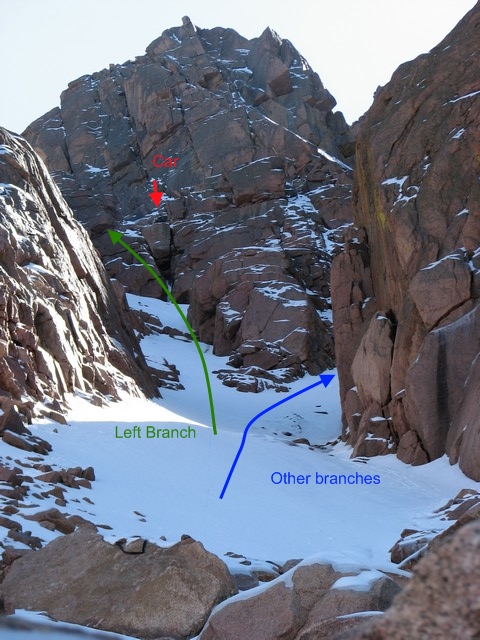
After staying left of the large rock in the center of the photo above just follow the couloir the rest of the way to the summit. As you near the summit the couloir opens up and slightly eases it's slope.
Y-Couloir Direct
This is the most popular of the branches. The terrain naturally funnels climbers up this one, and skiers have a shorter easier trip to get to skiable snow at the top of this couloir (though it is narrower than the other branches.)Once into the Y-Couloir pass through the narrows and veer slightly right away from the left branch you will come to this intersection:
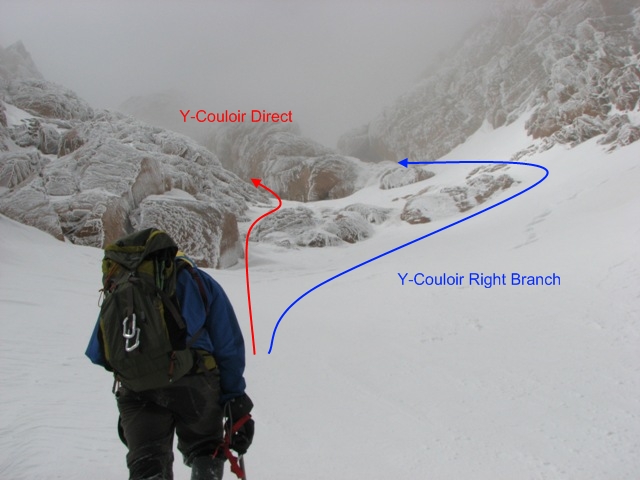
This small cliff band can be tricky when covered in ice, but generally doesn't present too much of a challenge. Once past this intersection follow the couloir straing to the summit. The finish on this one is fantastic, it narrows and gets steeper until the very last moment when you step onto the summit.
View a trip report from this route HERE.
Right Branch
This is the easiest of the Branches and has two choices for a finish. The farthest right (west) is described by Roach in his Colorado's Fourteeners book. This is the one that ends at the last Pikes Peak highway switchback.Once beyond the narrows of the couloir keep right against the cliffs. As noted below you will need to take the path high to the right to enter this branch.
Once beyond this you can either continue to stay right and end at the last switch back, or watch to your left for a reasonable exit and end closer to the summit.
Total Abandon and Blind Assumption
These two couloirs are the most technical of the North Face couloirs. I have not done them. Below are links to the Mountain Projects sites for these routes. These routes require the use of trad alpine protection. They are not for beginners. In the winter they can be done as ice climbs though usually only for short periods of time. In the summer after the ice melts out they are chimneys with hazardous loose rock.Total Abandon
Blind Assumption
The Railroad Couloir
The railroad couloir is the tamest of the couloirs, but still should not be underestimated. From the bottomless pit head southwest staying in the lowest gully. You will pass what's left of an old pickup driven off the summit by a suicidal college student. Then you will pass the Y-Couloir entrance. Continue up the gully keeping next to the cliffs on your left.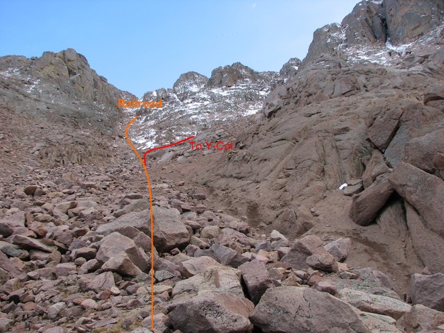
When the gully reaches a point where you are forced to turn left this is the base of the Railroad Couloir. The route will becomes steeper but you're very close to the summit.
About 3/4 of the way up the gully look for a right exit just below a rock pillar. Turn right into this gully then left again to finish at the end of the railroad tracks. An alternate finish is to stay left of the rock pillar. This will finish a little short of the summit. It is also a little more difficult than the standard finish, but has far less risk of tourists throwing rocks down on you as you ascend.
Click Here for a ski/hiking report from the Railroad Couloir.
You are welcome to contact me with any questions regarding questions about, or problems with, this website. Just send me an e-mail at josh_friesema@hotmail.com.