Centennial Trail
 |
 |
 |
 |
 |
 |
 |
 |
 |
 |
 |
 |
 |
Distance:
15 miles
Type:
Double Track
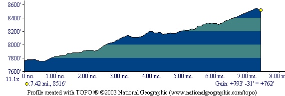
Vertical Gain:
800 ft
Difficulty:
Easy but long
Topographical Map:
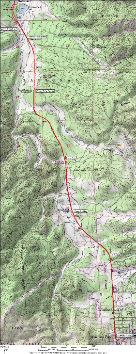
Click here for a larger version of this map.
Elevation Profile:
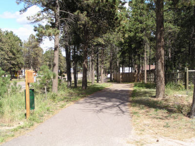
Trailhead: From the intersection of Highway 24 and Highway 67 in Woodland Park, head North on Highway 67 for 100 yards and turn right onto Midland Avenue by Pikes Peak Credit Union. Just after the Credit Union on the left side is a parking lot in front of an old log building. This is the trailhead parking area.
Summary:From the parking lot head West on Midland Avenue. Just before you reach highway 67 you will see the paved trail paralleling it heading North. Follow this paved trail all the way to Manitou Lake. Keep in mind it is mostly down hill all the way to the lake and up hill all the way back. If you'd rather, you can park at Manitou Lake (there is a fee to park in the day use area) and do this trip in the opposite direction. The map above details several other parking spots that will work to begin this trail.
This trail is far from straight as it winds its way through the trees.
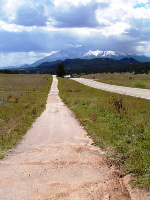
Views of Pikes Peak grace the trail.
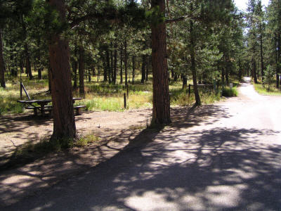
A couple of resting spots along the way provide good locations for picnics.
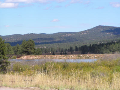
Manitou Lake is not big, but provides a nice serene location for a turnaround.
You are welcome to contact me with any questions regarding questions about, or problems with, this website. Just send me an e-mail at josh_friesema@hotmail.com.
|
Distance: |
15 miles
|
|
Type: |
Double Track
|
|
Vertical Gain: |
800 ft
|
|
Difficulty: |
Easy but long
|