The Crags
 |
 |
 |
 |
 |
 |
 |
 |
 |
 |
 |
 |
 |
Distance:
3.75 miles
Type:
Single Track
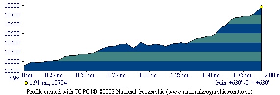
Vertical Gain:
650 ft
Difficulty:
Easy
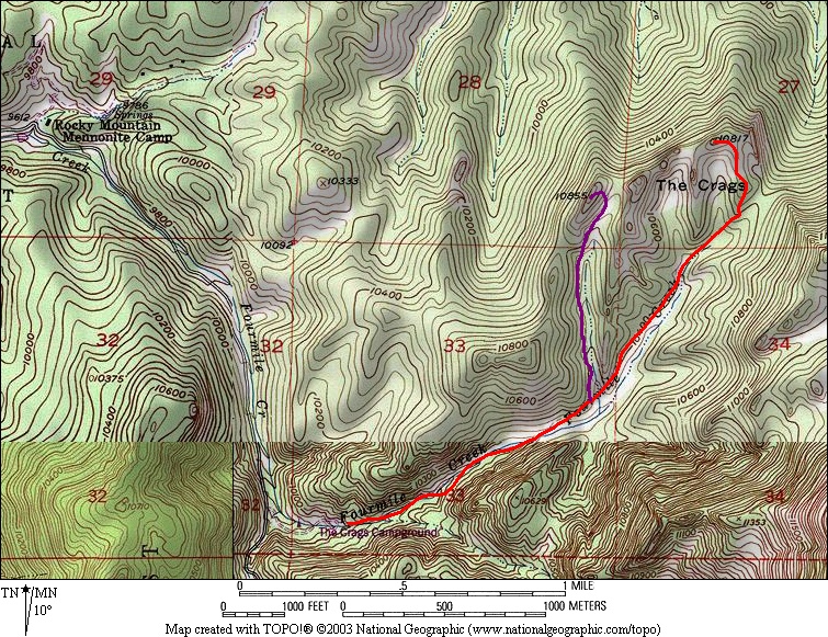
Topographical Map:
Elevation Profile:
Trailhead: From the town of Divide, head South on Highway 67 for 4.3 miles to the Crags Campground turn on the left side of the road. A small forest service sign marks this turn, watch carefully as it is easy to miss. Follow this road as it heads East towards Pikes Peak. When you reach the Mennonite Camp turn right after passing a small pond. This turn is also signed. Continue on until you see the signs on the left for the Crags Campground. Turn into the campground and drive all the way through it to the large parking lot at the opposite end. There is a outhouse here and signs labeling the trailhead.
Summary:From the trailhead head NorthEast up a short set of stairs and the sign labeling the trail. This trail will wind through the trees staying on the NorthWest side of a stream. After a mile you will come to a clearing and a Y in the trail. Either will lead you to the Crags, however the prefered route is to take the trail on the right. This will lead you to better views. The last half mile is the steepest but worth completeing.
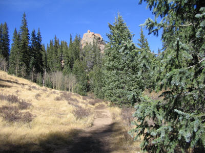
This trail is through some nice woods and fields.
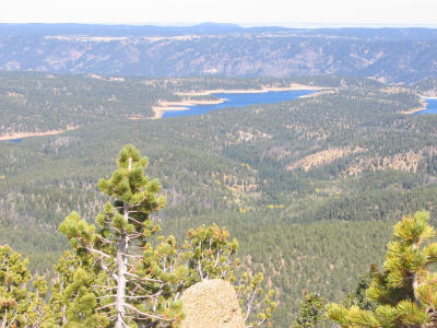
North Catamount Reservoir is clearly visible from the Crags.
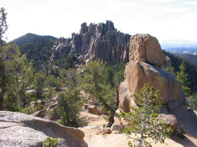
A view of the Crags.
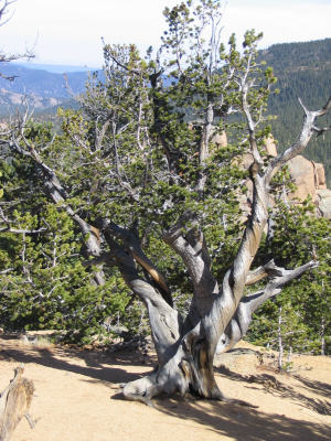
The wind takes its toll on several of the trees in this area, leaving in a very artistic appearance.
You are welcome to contact me with any questions regarding questions about, or problems with, this website. Just send me an e-mail at josh_friesema@hotmail.com.
|
Distance: |
3.75 miles
|
|
Type: |
Single Track
|
|
Vertical Gain: |
650 ft
|
|
Difficulty: |
Easy
|