Manitou Incline / Mount Manitou
 |
 |
 |
 |
 |
 |
 |
 |
 |
 |
 |
 |
 |
Distance:
3.25 miles
Type:
Double/Single Track
Vertical Gain:
2100 ft
Difficulty:
Difficult
Click Here to visit the ManitouIncline.Net webpage
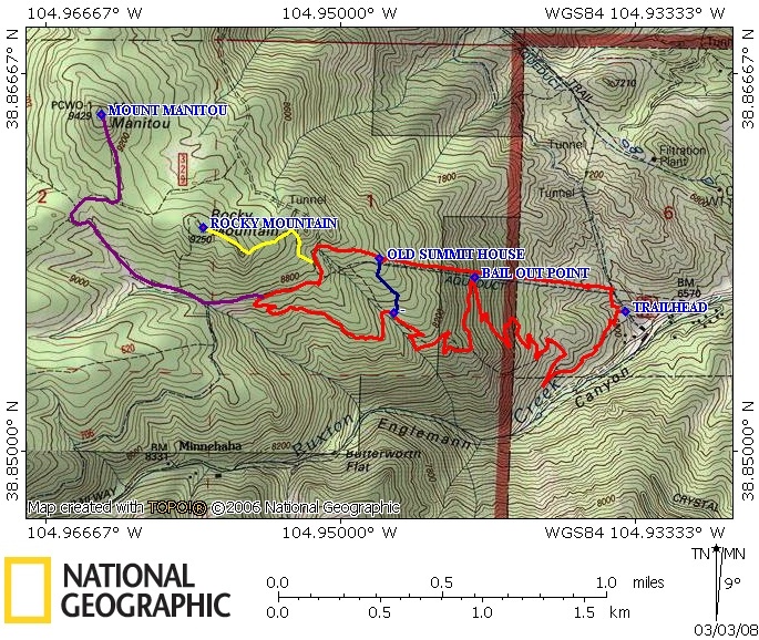
Topographical Map:
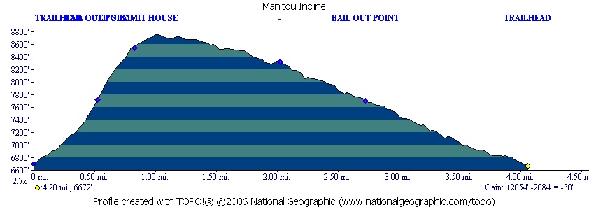
Elevation Profile:
Trailhead:
To reach the trailhead take Business 24 through Manitou Springs. Near the center of historic Manitou Springs look for the turn South that is labeled for the Pikes Peak Cog Railway. Follow this road past the Cog railway station to it's end. At the end of the road you can take a right turn that will take you up a steep hill to the parking lot for the Barr trail. This is where you must park. This parking lot frequently fills up. If it is full, DO NOT park in the Cog Railway parking. They will tow you.
Summary:
Warning: This trail crosses private property
Currently efforts are in progress to make this a public trail. However until then, if you hike this trail you are treaspassing.
From the parking lot head North up the hillside using the trail that has been developed. Continue North until you reach the old railroad bed. The rails have been pulled up, however the old ties remain. Hike west on the railroad bed. The trail is obvious before you as it ascends the mountian. The slope of this trail will reach 50 degrees at one point, which is why so many people use this trail for a workout. It will test your strength and endureance. (If the trail proves to be too much there is a bail-out point where the Barr trail is just across a gully from this trail) You will pass one false summit before you reach the remains of the old summit station. Most people find the views here to be all they need and head South down the hill to connect with the Barr trail and return to the parking lot. (DO NOT hike back down the incline trail, this will only result in blown knees and bad falls) If you need more views use the map provided to find your way up to the Eagles Nest or Mount Manitou. I have not done this part of the hike for many years and cannot give an accurate description.
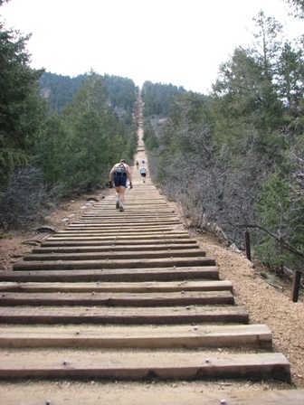
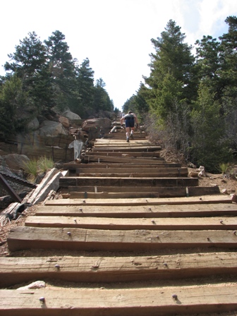
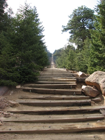
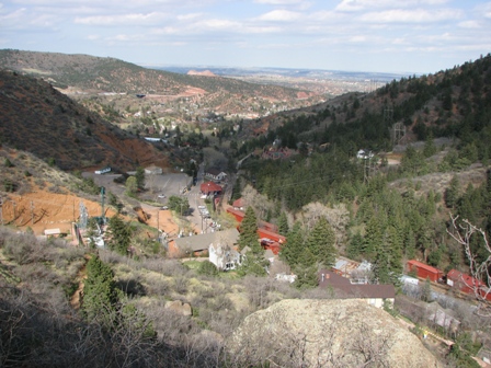
The view when you get onto the trail is a little intimidating. That's 2000 vertical feet baby.
For a while the tracks get wider where the trains used to pass each other.
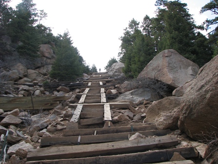
As the trail steepens the condition begins to deteriorate.
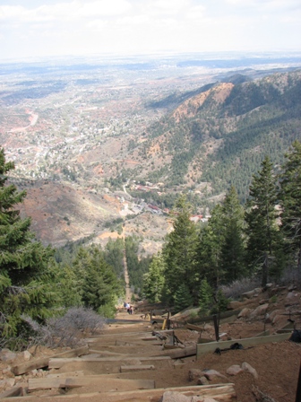
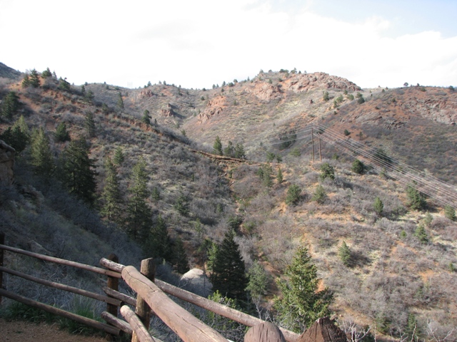
Don't forget to look over your shoulder every now and then to check out the views.
The steepest section has had a lot of work done to keep it hikeable. You're doing a 50 degree slope here.
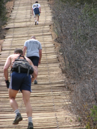
You will likely be on this trail with several people who use it for a work out so try to step out of their way when they pass.
Just after the steepest section is the false summit. Just when you think you're there, you've got another hill to climb.
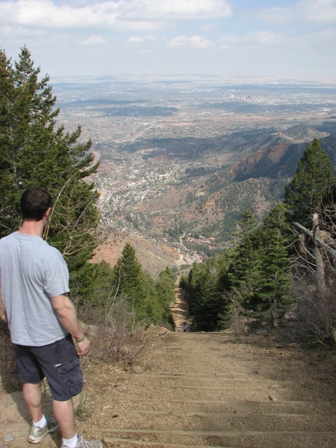
The view from the top is thrilling if for no other reason than that your done.
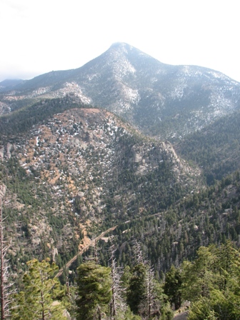
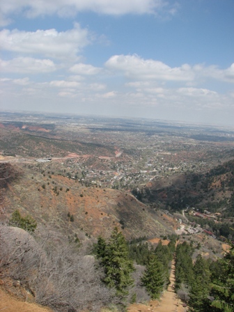
Camerons Cone dominates the view during your descent, plus you can see the Cog Railway in the valley below.
The Barr trail is well used and makes for an easy descent that won't destroy your knees. Many people choose to jog this descent.
The Barr trail will bring you back down just above the Cog Railway buildings.
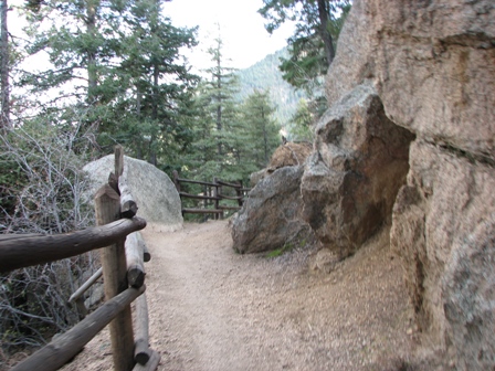
This shot taken from the Barr shows a good view of the beginning of the Incline trail.
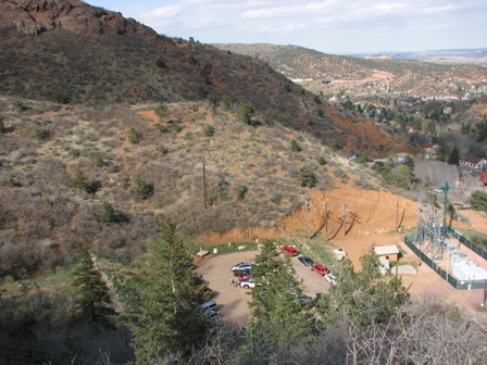
The parking lot is usually tight from early morning to late evening all week long.
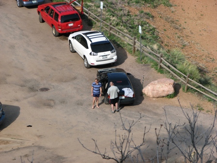
Nate and Jason waiting for me. They jog, I don't.
You are welcome to contact me with any questions regarding questions about, or problems with, this website. Just send me an e-mail at josh_friesema@hotmail.com.
|
Distance: |
3.25 miles
|
|
Type: |
Double/Single Track
|
|
Vertical Gain: |
2100 ft
|
|
Difficulty: |
Difficult
|
The view when you get onto the trail is a little intimidating. That's 2000 vertical feet baby.
For a while the tracks get wider where the trains used to pass each other.
As the trail steepens the condition begins to deteriorate.
Don't forget to look over your shoulder every now and then to check out the views.
The steepest section has had a lot of work done to keep it hikeable. You're doing a 50 degree slope here.
You will likely be on this trail with several people who use it for a work out so try to step out of their way when they pass.
Just after the steepest section is the false summit. Just when you think you're there, you've got another hill to climb.
The view from the top is thrilling if for no other reason than that your done.
Camerons Cone dominates the view during your descent, plus you can see the Cog Railway in the valley below.
The Barr trail is well used and makes for an easy descent that won't destroy your knees. Many people choose to jog this descent.
The Barr trail will bring you back down just above the Cog Railway buildings.
This shot taken from the Barr shows a good view of the beginning of the Incline trail.
The parking lot is usually tight from early morning to late evening all week long.
Nate and Jason waiting for me. They jog, I don't.