Pikes Peak from Crags Campground
 |
 |
 |
 |
 |
 |
 |
 |
 |
 |
 |
 |
 |
Distance:
12.75 miles
Type:
Single Track out-and-back
Vertical Gain:
4200 ft
Difficulty:
Strenuous
Topographical Map:
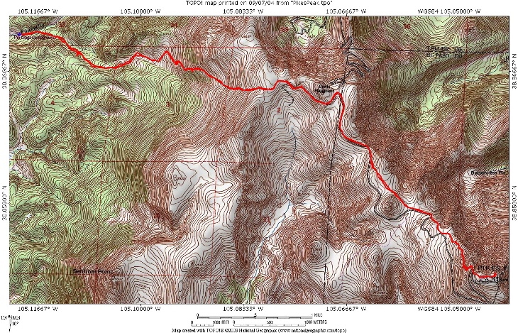
click here for larger map.
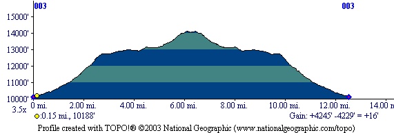
Elevation Profile:
Trailhead:
From the town of Divide, head South on Highway 67 for 4.3 miles to the Crags Campground turn on the left side of the road. A small forest service sign marks this turn, watch carefully as it is easy to miss. Follow this road as it heads East towards Pikes Peak. When you reach the Mennonite Camp turn right after passing a small pond. This turn is also signed. Continue on until you see the signs on the left for the Crags Campground. Turn into the campground and drive all the way through it to the large parking lot at the opposite end. There is a outhouse here and signs labeling the trailhead.
Summary:
From the parking lot head East on the trail labeled for the Crags. Watch carefully for a trailpost marking the intersection of trail 641A, this intersection is only a tenth of a mile down the trail. Follow this trail which immediately crosses a log bridge over the stream. After a short distance it will pass another sign telling you that you are headed towards Devil's Playground. This is the correct route. Before the trail reaches treeline it will pass through a loose steep section that can be very tiring, however the Friends of the Peak club should have this section fixed in the next year or so. Once you break treeline the grade of the trail begins to relent, and a saddle will be visible ahead. When the trail crosses over this saddle look for an old road and follow it East through the Devil's Playground. After Devil's Playground (the rocky formations) you must cross the Pikes Peak Highway and find the walking path on the other side. It is illegal to walk on the road and the road is heavily patroled. The summit will be visible in the distance, but you still have a ways to go. Follow the foot path as it takes a fairly direct line towards the summit. Just before you reach the summit you will come to the final steep section of a boulder field. Look for cairns (stacks of rocks) that mark the route, if you follow them the trail will be easy though the terrain is rough. You will reach the summit abruptly after this section. Stroll across to the far side of the summit and visit the restaurant for a snack before your trip down. For a $5 fee on your return trip a van will shuttle you back down to Devil's Playground.
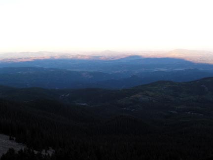
In the morning during your ascent you can see the shadow of Pikes Peak as it stretches out for miles.
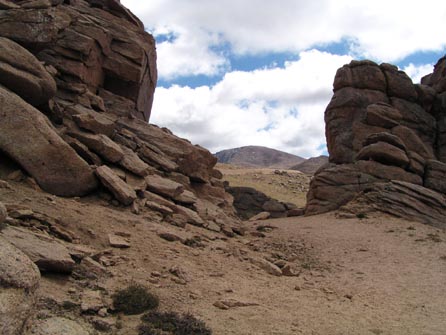
Devil's Playground.
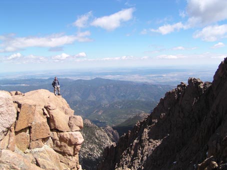
There are many vistas along the way to stop and take in the views.
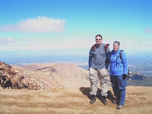
On the summit of Pikes Peak there is rarely a problem finding a person to take your picture for you.
|
Distance: |
12.75 miles
|
|
Type: |
Single Track out-and-back
|
|
Vertical Gain: |
4200 ft
|
|
Difficulty: |
Strenuous
|