Raspberry Mountain
 |
 |
 |
 |
 |
 |
 |
 |
 |
 |
 |
 |
 |
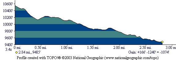
Distance:
5.75 miles
Type:
Double Track/Single Track out-and-back
Vertical Gain:
1400 ft
Difficulty:
Moderate
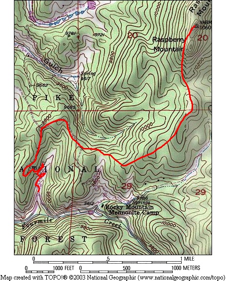
Topographical Map:
Elevation Profile:
Trailhead:
From Divide Colorado take Highway 67 South for 3 1/2 miles to the Crags Campground/Mennonite camp turn on the left (East) side of the road. This turn is between some guard rails just after a right curve in the road, it's easy to miss so don't be surprised if you need to turn around a time or two. Once on the dirt road, follow it for about a mile until you come to a sharp right turn in the road that crosses a small valley. The trailhead will be on the left side and you will see a gate that blocks vehicle access to this trail. Parking is allowed in front of the gate. There is room for only a few cars, but this is rarely a problem.
Summary:
From the trailhead the trail is obvious as it is an old road that leads up the hillside before you through a short series of switchbacks. There will be a couple of intersections with other roads, but simply follow the most heavily traveled route. (One mistake to avoid is following the road that runs directly below some powerlines.) If you keep a watchful eye out you will see a bench not too far off the trail hewn from an old log. This bench is in memory of someone who hiked this area. If anyone has more information on it, I would love to hear about it. Once the road reaches the ridge it will stay on top as the road curves around and leads you towards the summit. The road will end short of the summit though. (Avoid taking a spur road that leads quickly downhill to the Northeast.) When you reach the end of the road conintue along the ridge and find a single track foot path that will take you to the summit. The summit is a large block of rocks that is easiest to get on top of by circling around its West side and climbing it from the North. Once on top of this rocky summit you will be well above the trees and have excellent views all around. It is very likely the only people on this summit will be you and those you brought with you. Return the way you came.
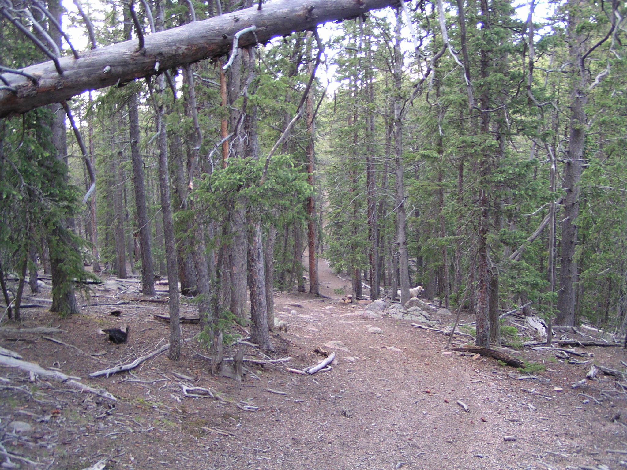
The trail begins as an old road that winds through the trees in Pike National Forest.
Along the way you will be able to see Sentinel Point. This point is an excellent landmark you can use as a point of reference as you hike.
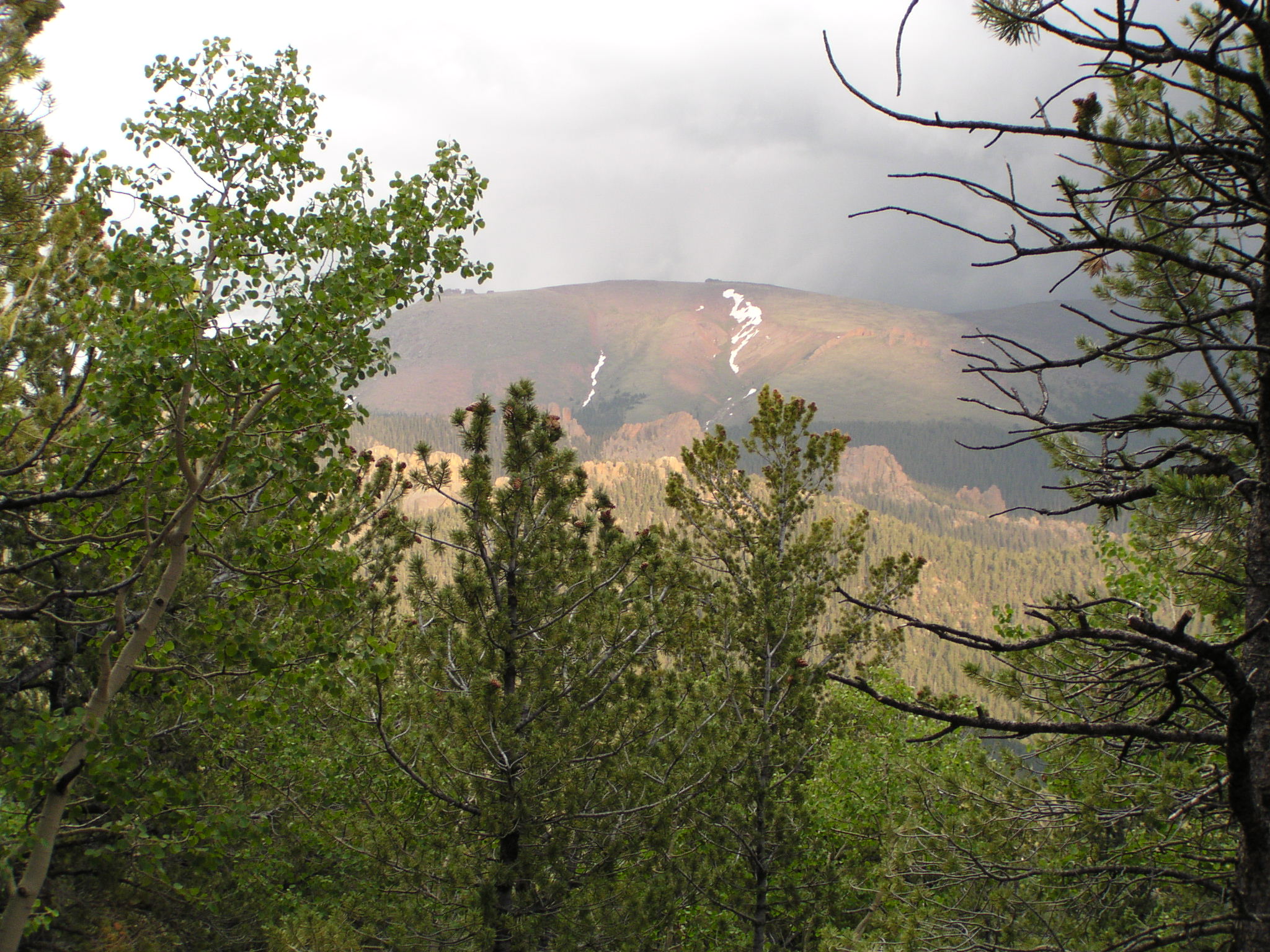
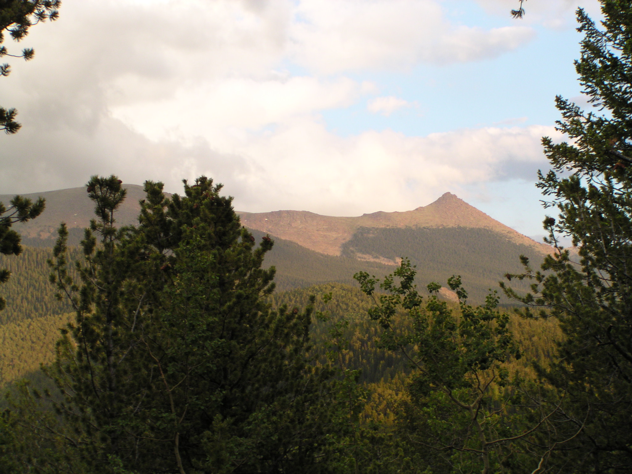
Pikes Peak is quite difficult to see through the trees during this hike. A few small gaps will give you a preview of the upcoming view you will have at the end of the trail.
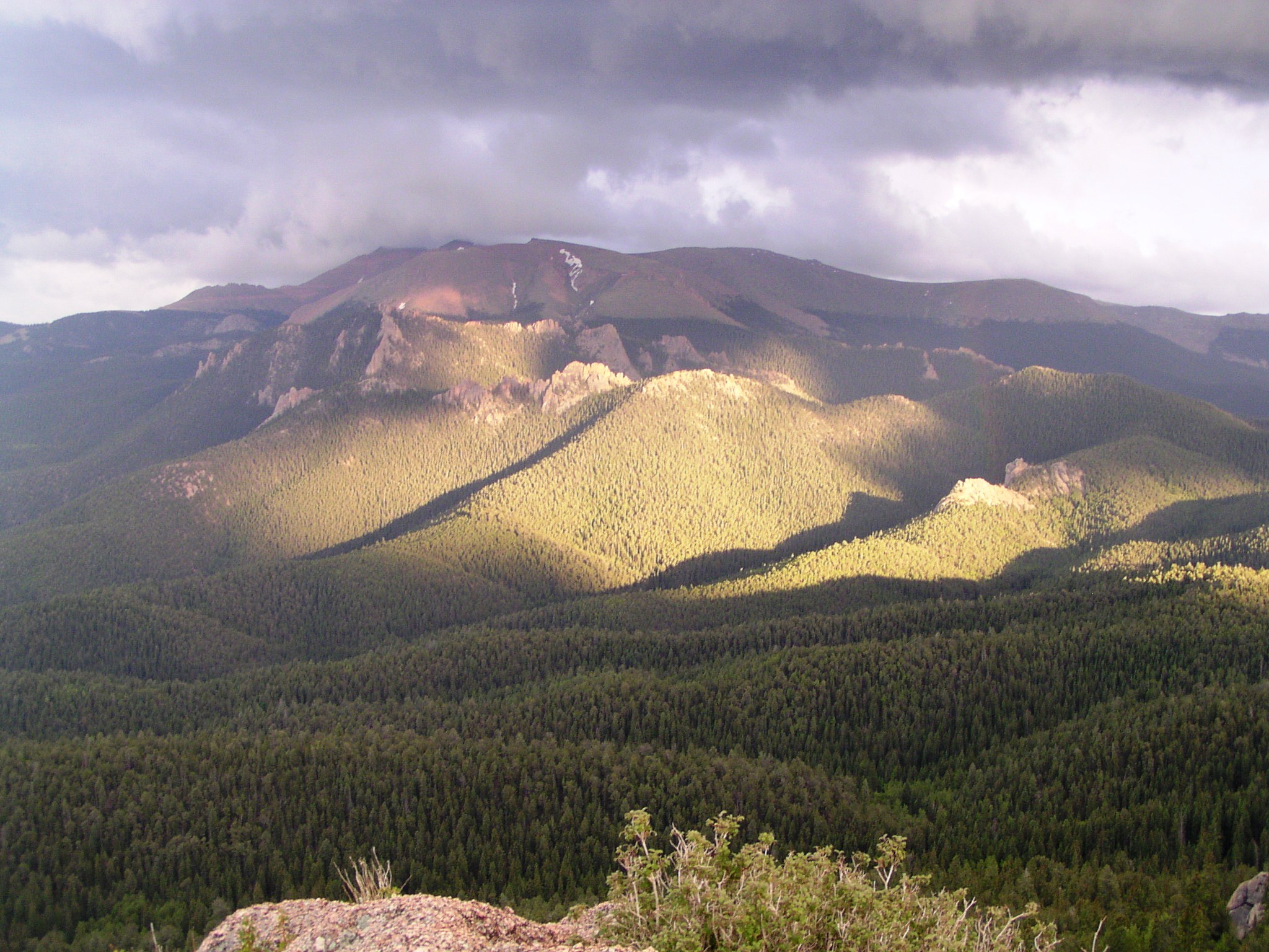
Once you reach the summit, the view of Pikes Peak and the Crags opens up dramatically.
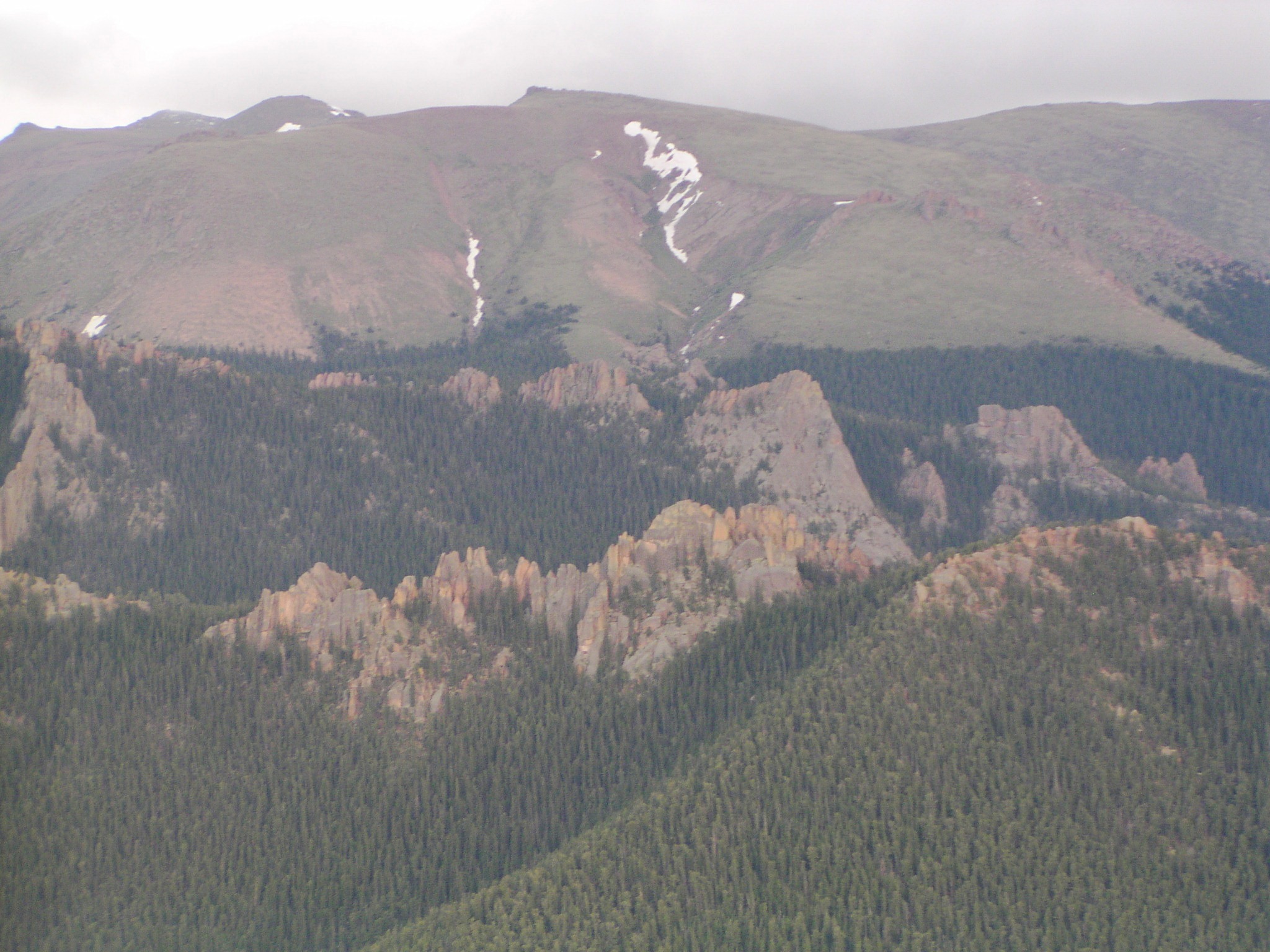
The Crags are a rocky outcropping on the West side of Pikes Peak at the center of this photo. These rocks are frequented by climbers. Due to their remoteness they are never very crowded.
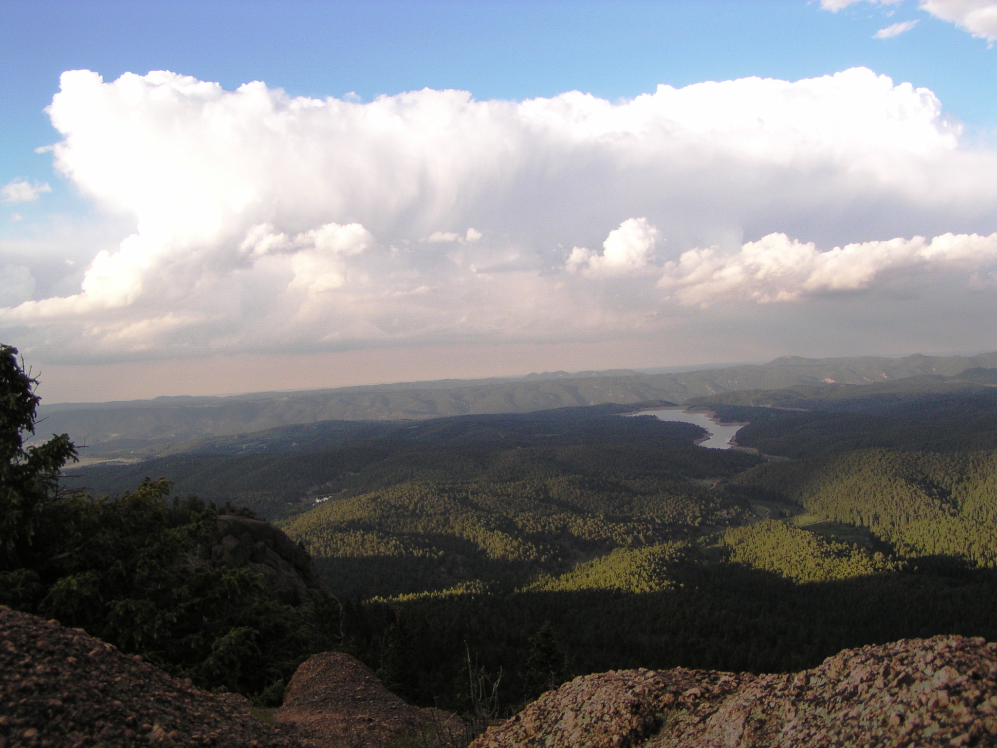
Looking Northeast you will be able to see North Catamount Reservoir and Rampart Range.
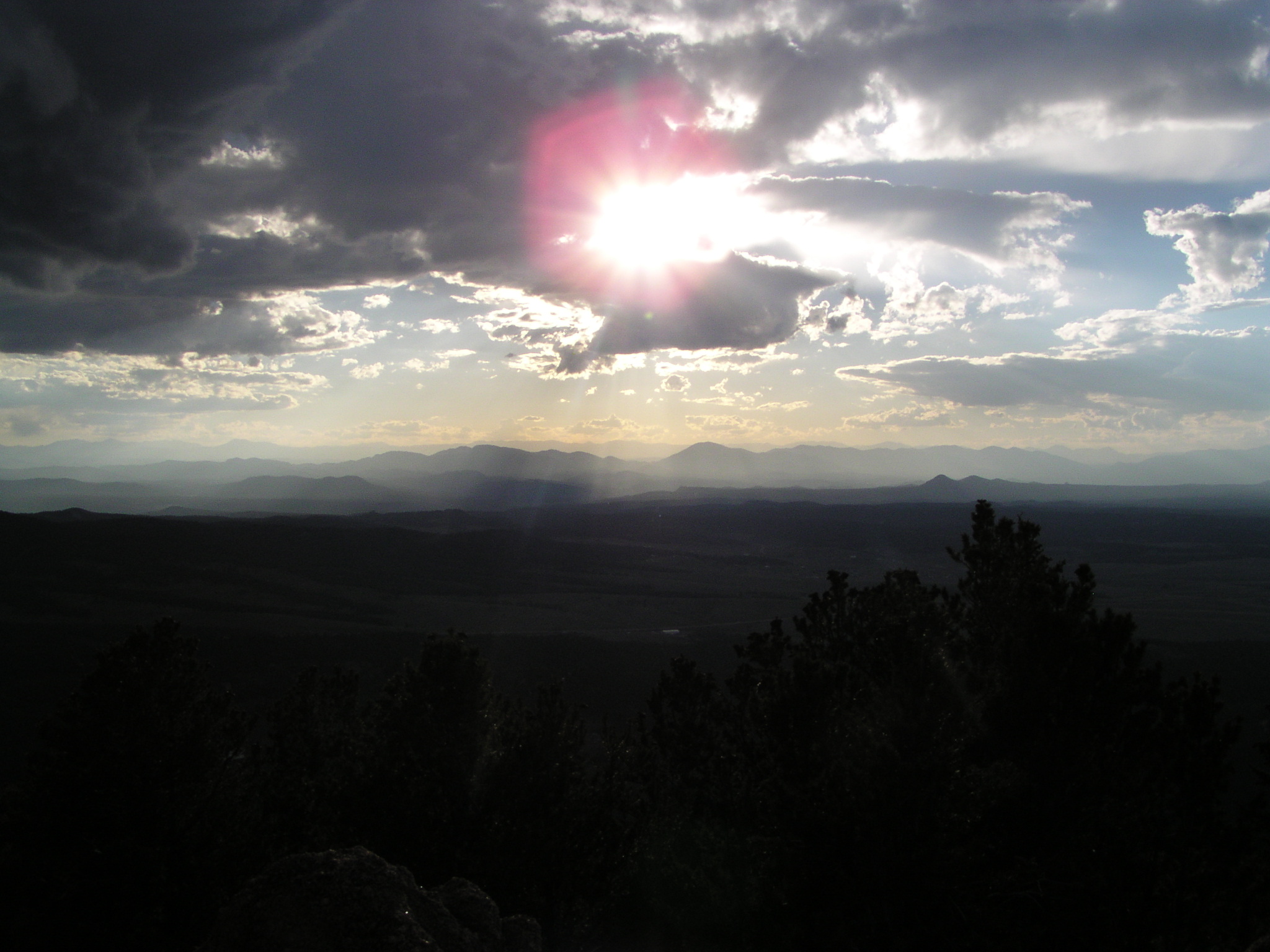
To the west you can see the Sawatch Range, South Park, The Tarryalls, and many other features.
|
Distance: |
5.75 miles
|
|
Type: |
Double Track/Single Track out-and-back
|
|
Vertical Gain: |
1400 ft
|
|
Difficulty: |
Moderate
|