Sentinel Point
 |
 |
 |
 |
 |
 |
 |
 |
 |
 |
 |
 |
 |
Distance:
6.5 miles
Type:
Single Track/trailblazing
Vertical Gain:
2,800 ft
Difficulty:
Difficult/Trailblazing/Light Bouldering
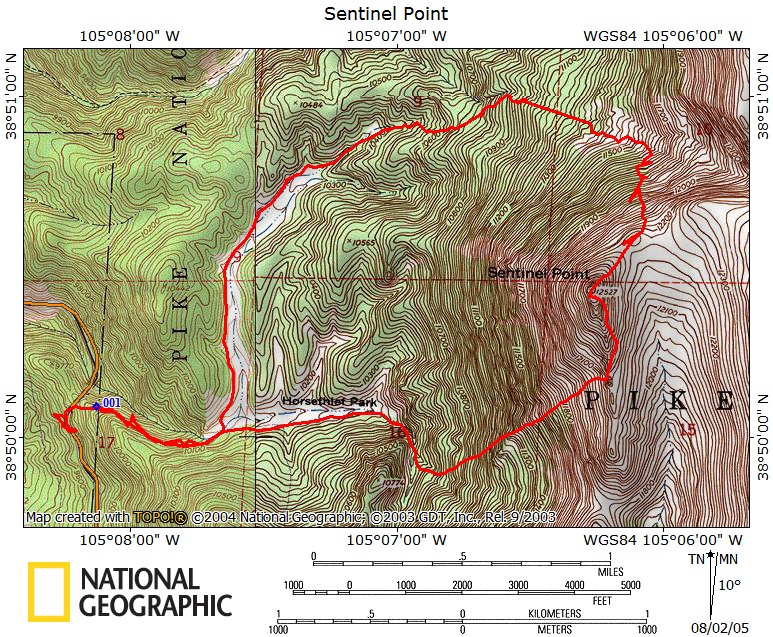
Topographical Map:
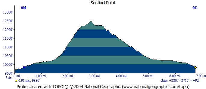
Elevation Profile:
Trailhead:
From Divide Colorado take Highway 67 South. Follow Highway 67, and watch for an old railroad tunnel on the left side of the road. Pass the old tunnel entrance (up until a few years ago the road went through this tunnel) and go through a large cut in the hill side to the other side of the tunnel. There is a parking lot at the far side of the tunnel on the left (East) side. Park here, this is the trailhead.
Summary:
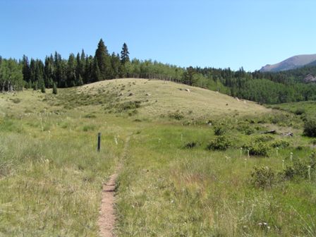
The trail begins at the South end of the parking lot. After a quick pair of switch backs, the trail joins up with what used to be a road leading to Horsetheif Park. Just as the trail reaches Horsethief Park (a large flat field), look on the left for a trail leading North labeled as part of the ring the peak trail. Take this trail North along the bottom of a valley. Where the trail and valley start to turn East there will be a Y intersection. Take the right branch that continues up the valley and turns more East. At this point Sentinel Point will be the obvious summit on your right. This path will reach the end of this open valley and begin to climb up hill quickly. Watch for the path carefully (some cairns exist) as it begins to disappear. As you near treeline the path will become very difficult to discern. Continue uphill heading East along some gullies until the trees begin to fade. Look to your right and you will see a large boulder field that leads to the ridge of Sentinel Point. The easiest path is usually right along the trees that border the boulder field. There is no path here, so you must do some trailblazing. The trip to the ridge is steep. Once on the ridge turn right and head back West to the summit of Sentinel Point. As soon as it comes into full view you may want to stop and plan your route. To reach the summit you will have to do a little class 3 bouldering if you find the easiest route. Finding the easiest path is mere chance. My best advice is that the true summit is right (North) of what appears to be the summit, and that a direct approach is not the best way to go. Start left and come back to the right. You may find yourself backtracking a few times. There is a USGS marking embedded into the rocks to mark the true summit.
You can return the way you came, however I prefer loop hikes. Descend East from the summit until traveling South is easy, then turn South. Parallel the ridge staying on the easy terrain. Watch for an open saddle on the ridge. This saddle is easy to cross and has no rocks in the way. Once you find this saddle cross it heading West and begin to descend back towards Horsethief Park. Across the valley below you and slightly to the South will be a large rock face on the opposite side. Head towards this face. After descending a long ways and just before you reach those rocks you will come to a stream. This stream feeds Horsethief falls, follow it down hill. Once you reach the falls, cross the stream to the South side and find the trail that will lead you back to the trailhead.
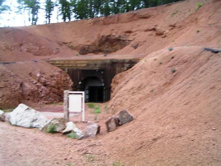
This is the South side of the old tunnel next to the parking area. Sorry about the blurry picture.
This is the Y intersection. The Ring the Peak trail goes Left, the Sentinel Point trail goes up the valley in the Right of the photo.
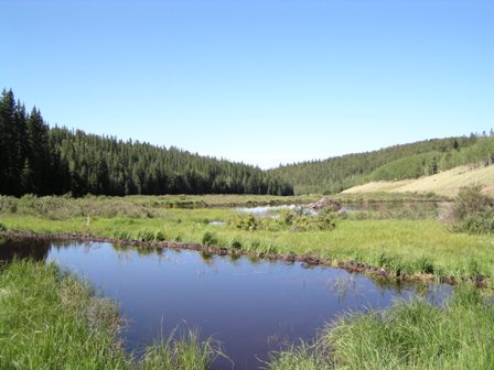
Near the end of the open valley, the trail will pass a couple of beaver ponds.
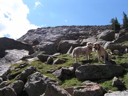
This was taken while climbing the steep section. As you can tell from the look of my dogs, this part can be very tiring.
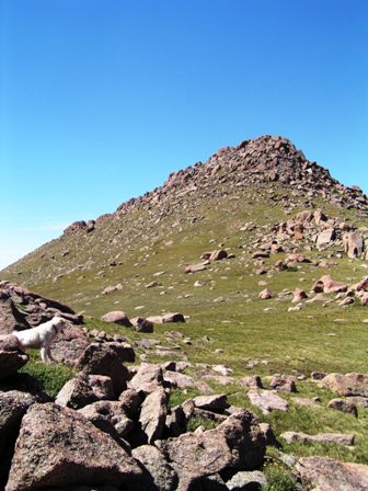
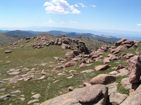
This is your first full view of the last pitch to reach the summit. This photo makes it look much smaller than it really is.
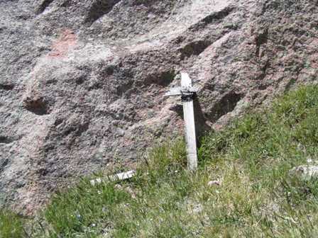
If during your ascent you happen to run across the remains of this old sign, you are on the easiest path to reach the summit. (I didn't find it until I was on my way back down.)
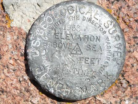
If you find this, you've reached the summit. My dogs came close, but were not able to climb the final section to the summit. It's tough but doable.
The saddle just to the right of center of this photo is the place to start heading West and down.
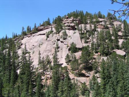
This is the rock slab you want to head towards as you descend from the saddle.
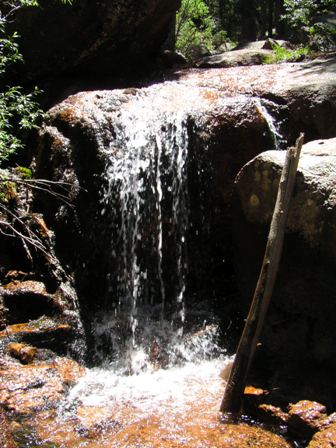
This is one of the early sections of Horsethief Falls, it is easiest if you wait until you've passed the main falls before you cross the stream.
|
Distance: |
6.5 miles
|
|
Type: |
Single Track/trailblazing
|
|
Vertical Gain: |
2,800 ft
|
|
Difficulty: |
Difficult/Trailblazing/Light Bouldering
|